As an individual with a love of hiking and travel and a curiosity about the world’s religions, my interest has been piqued by two ancient pilgrimages: the Camino de Santiago in Spain, which I’ve walked and biked previously, and the Kumano Kodo in Japan, a far lesser known pilgrimage that I learned about many years later. Interestingly, the Kumano Kodo shares the designation as a sister pilgrimage to the Camino de Santiago, and is also a UNESCO World Heritage Site. Completing both pilgrimages will earn one the title of “Dual Pilgrim”. (To learn more about the Camino de Santiago in Spain, see my blog post here.)
What is covered here:
- History and Significance of the Kumano Kodo
- The Routes of the Kumano Kodo
- Accommodations
- My Trip Along the Nakahechi Route
- Resources
History and Significance of the Kumano Kodo
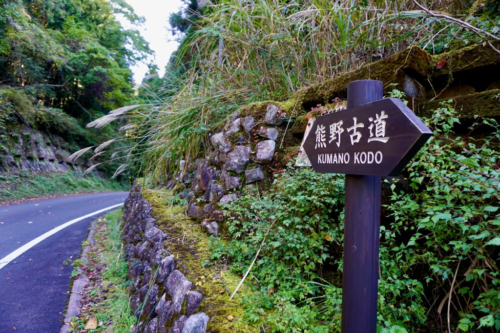
Kumano is the southern region of the Kii Penninsula and the spiritual heartland of Japan. Early pilgrims in the late 8th century would travel 30 to 40 days from Kyoto to reach this area. The Kumano Kodo refers to the network of trails that were formed by these ancient pilgrimage routes and which lead to the Kumano Sanzan, or the Three Great Shrines: Kumano Hongū Taisha, Kumano Nachi Taisha and Kumano Hayatama Taisha. Both Buddhism and Shintoism are represented on these trails.
Early pilgrims were primarily aristocrats, but with increased accessibility and affordability, the pilgrimage was soon accessed by everyday citizens. In 1998, the Kumano Kodo was recognized as a sister pilgrimage to the Camino de Santiago and in 2004 the Kumano Kodo was registered as a UNESCO World Heritage Site.
The Routes of the Kumano Kodo
There are multiple routes that form the Kumano Kodo with some being more rugged than others. One can pick the distance and type of route that suits them best. In all cases, they are a welcome respite from the hustle and bustle of the big cities.
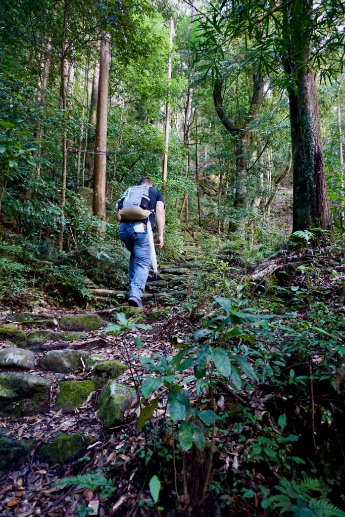
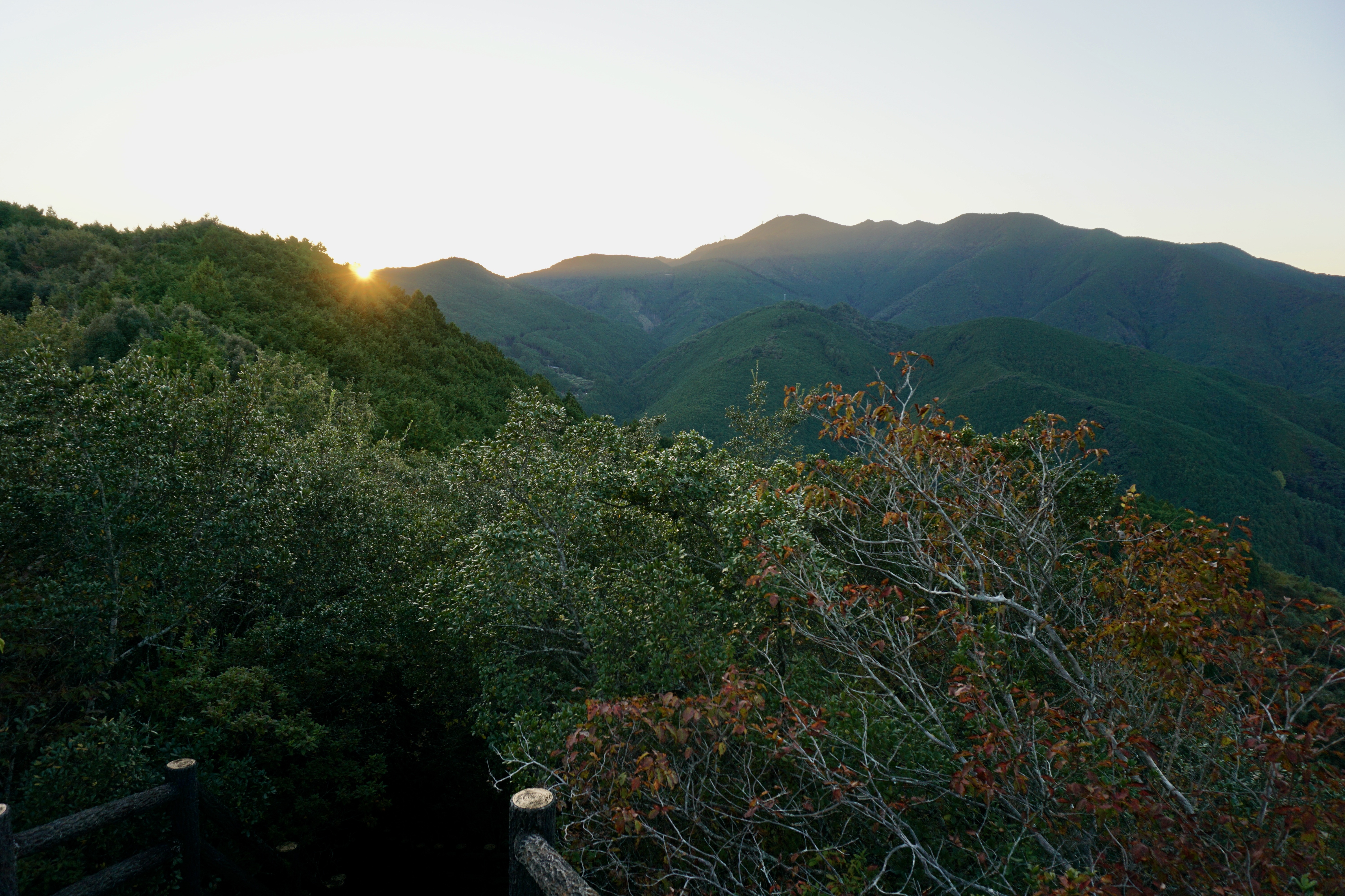
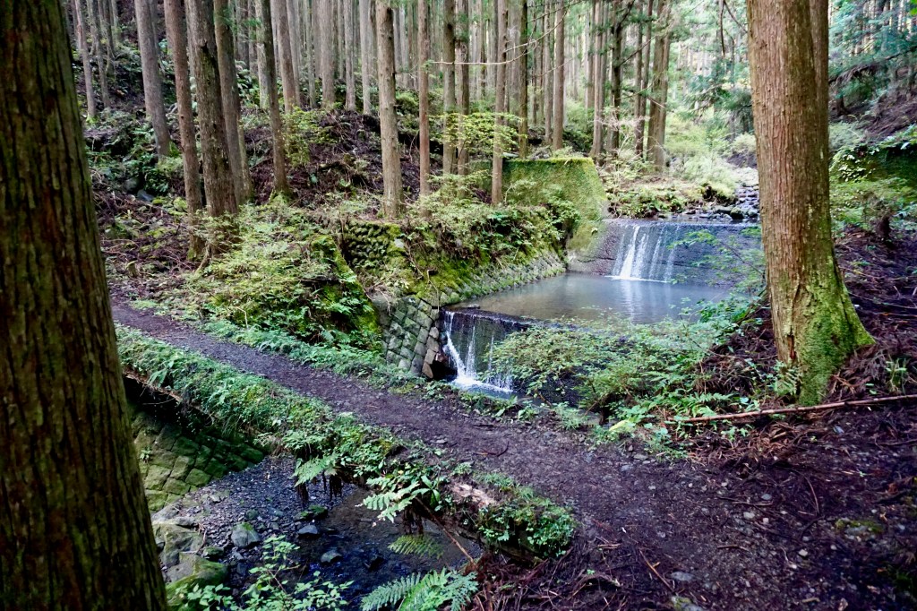
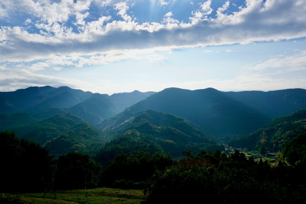
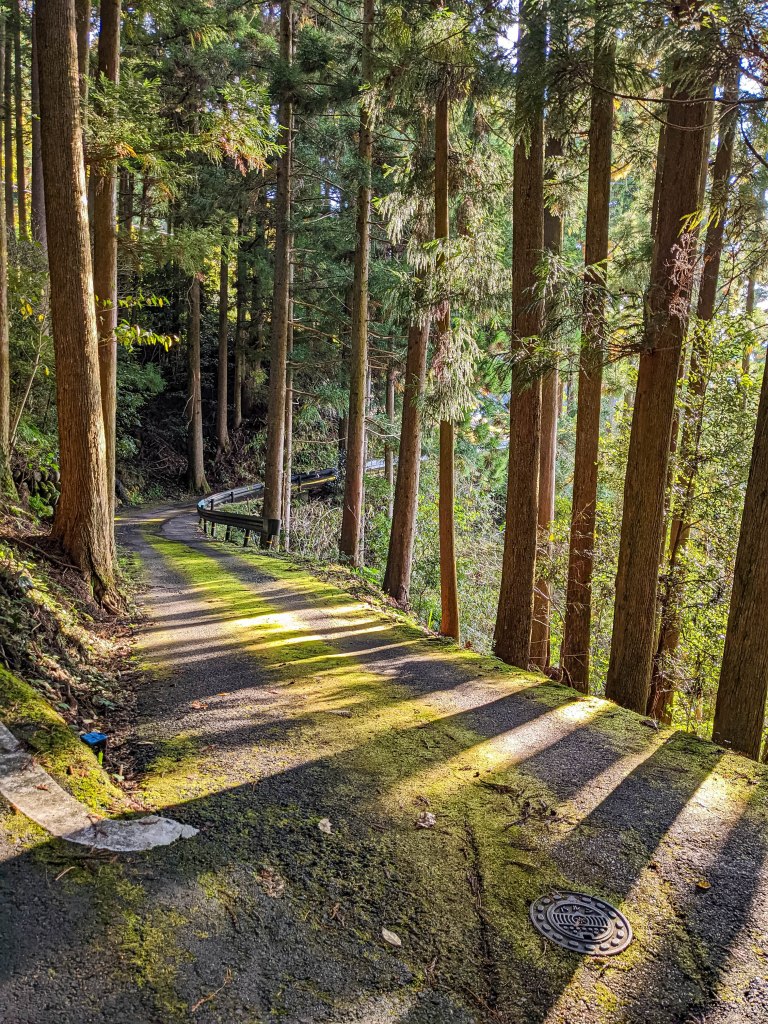
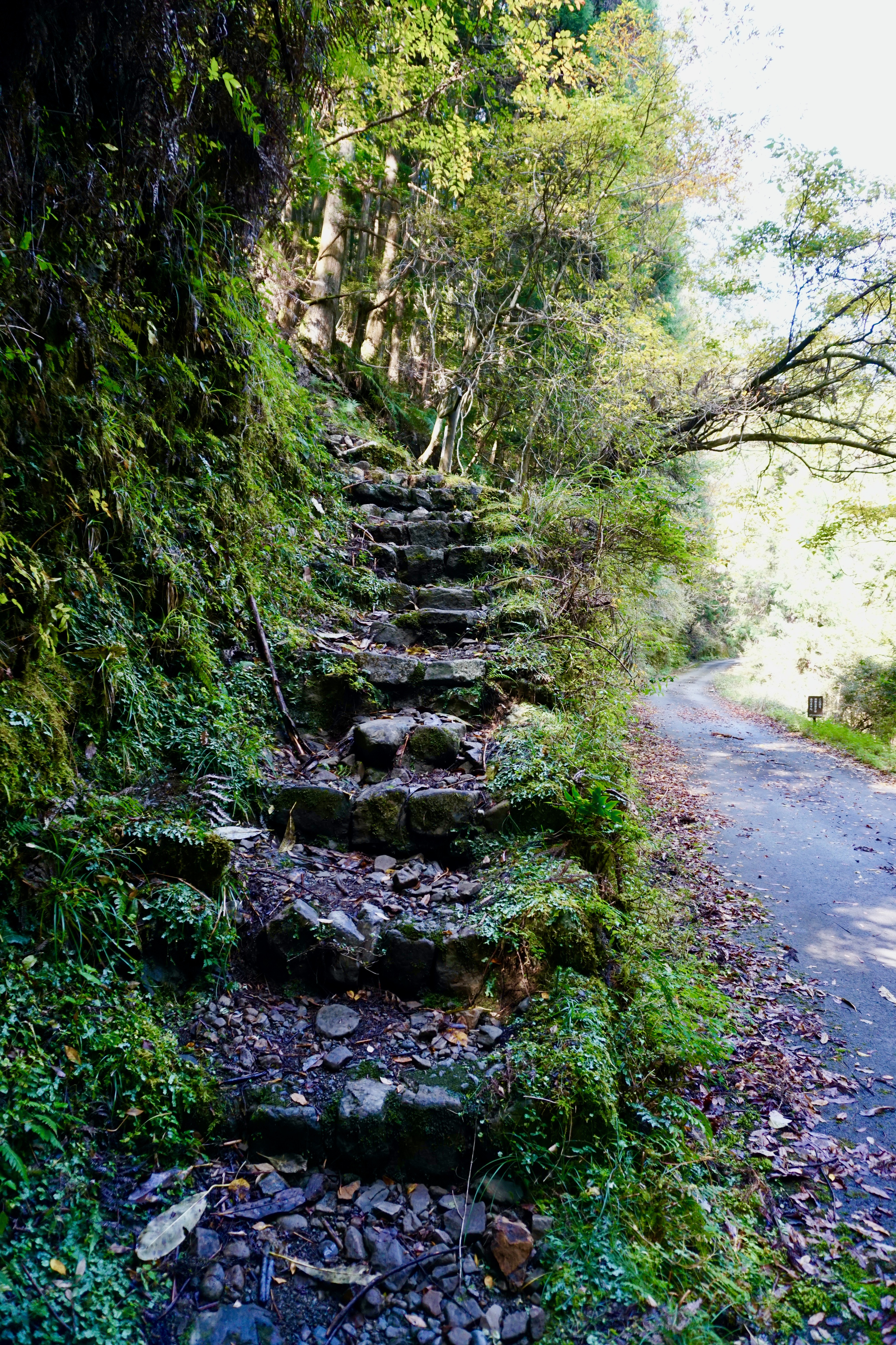
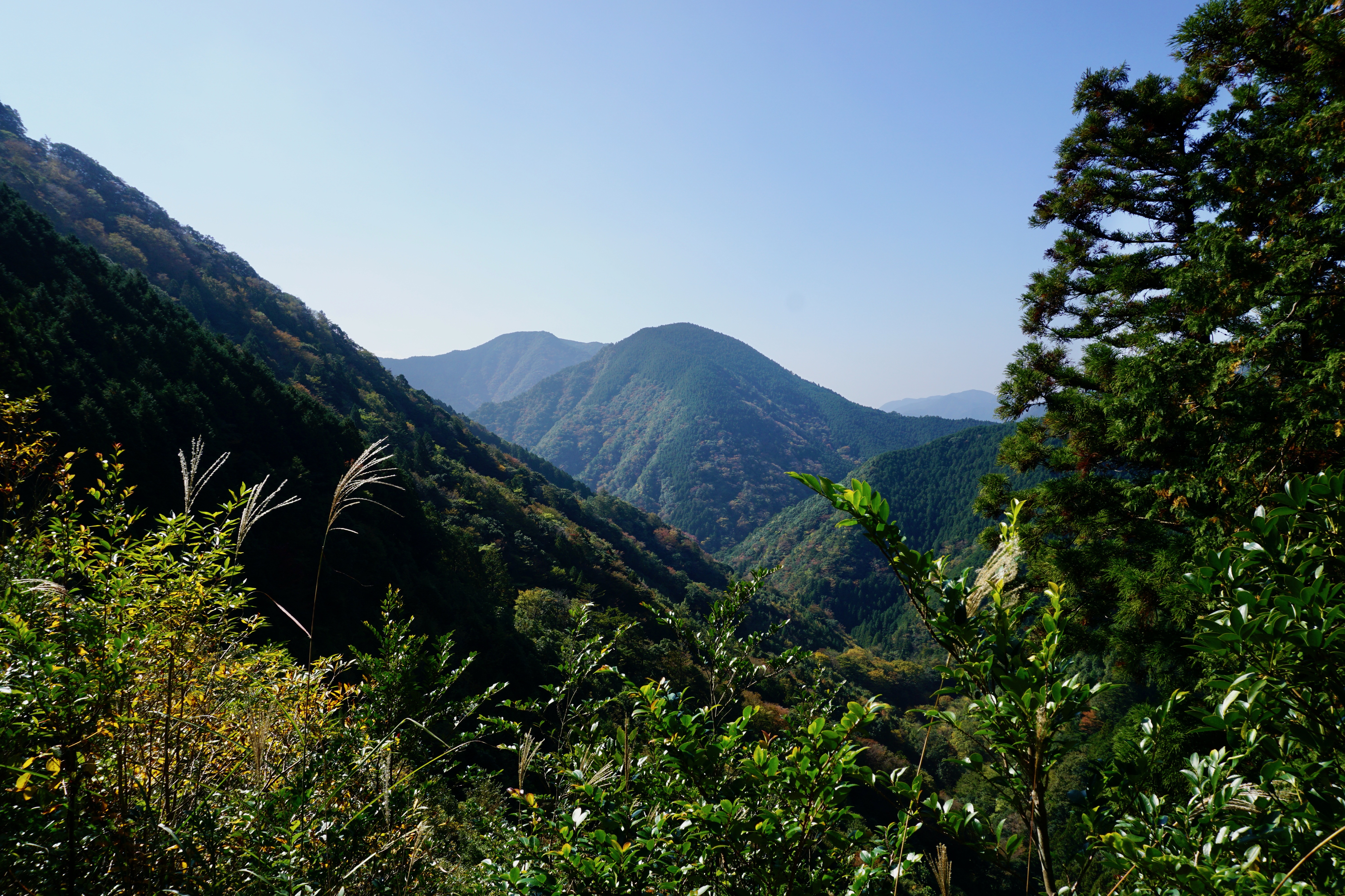
I specifically hiked the Nakahechi (traditional) Route. This route traverses through mountainous terrain along rugged paths with the occasional paved road that passes through local villages. Occasionally, the route will allow you to peek above the trees to see beautiful vistas and even pass through towns with hot springs. Be sure to take appropriate footwear and even trekking poles, as the more rugged paths can be steep with uneven terrain, large tree roots and slippery rocks (heed my word on this one!).
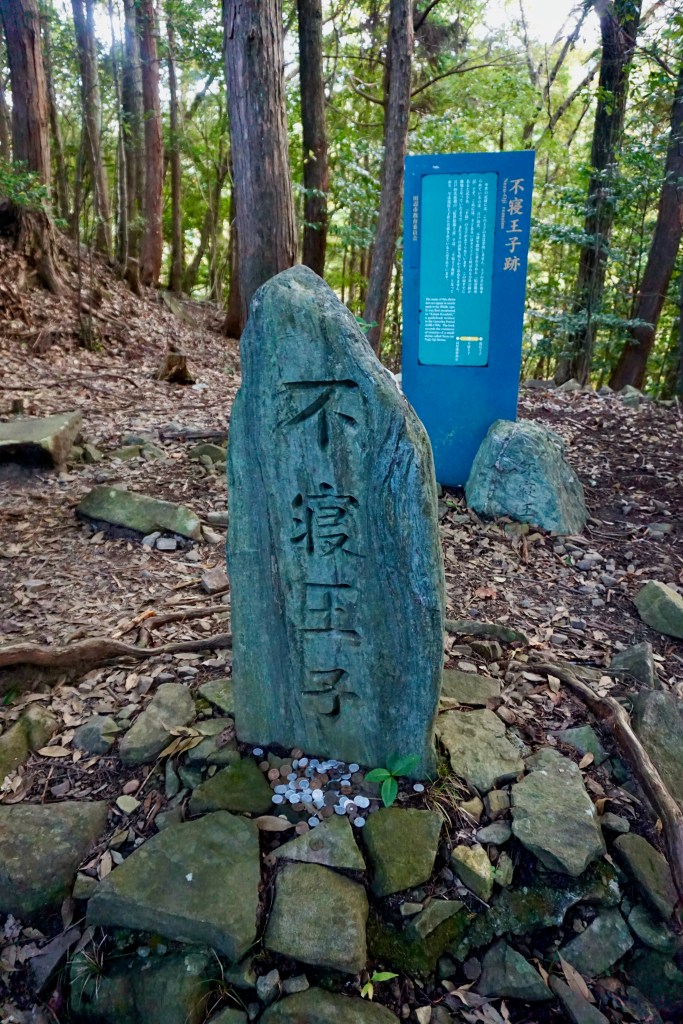
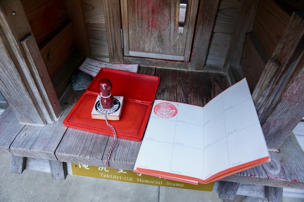
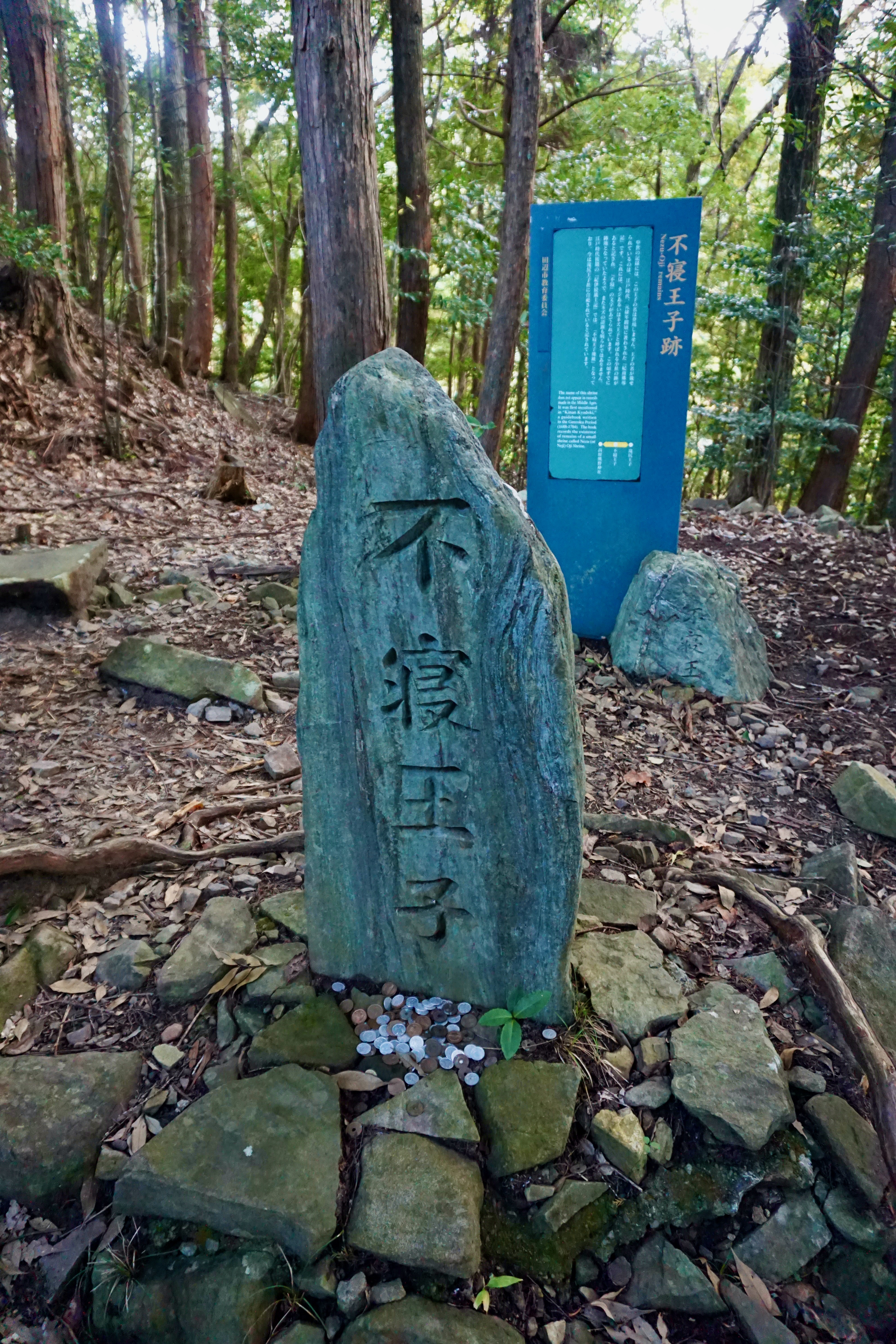
Along the route are small shrines, or ‘Oji”. These shrines serve as places of worship and rest, and may also have an associated stamp with which to stamp your Credential (see note below on becoming a Dual Pilgrim and the Credential).
A note about becoming a Dual Pilgrim. By completing both the Camino de Santiago in Spain and the Kumano Kodo in Japan, one can receive the designation of ‘Dual Pilgrim’. There are only four specific routes along the Kumano Kodo that will count for Dual Pilgrim status. I suggest looking at the official Kumano Tourism website for more details on these routes as I will not be covering all of them here. Additionally, be sure to get a Credential, which is a pilgrim’s passport, to stamp along the way. There are dual-sided Credentials for Dual Pilgrims, allowing you to track both pilgrimages on one Credential. Again, check tourism sites online and in -person to find out locations where the Credential can be obtained before starting your journey.
Accommodations
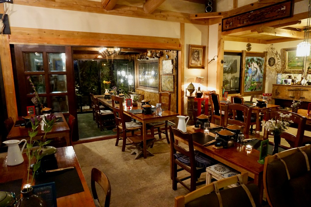
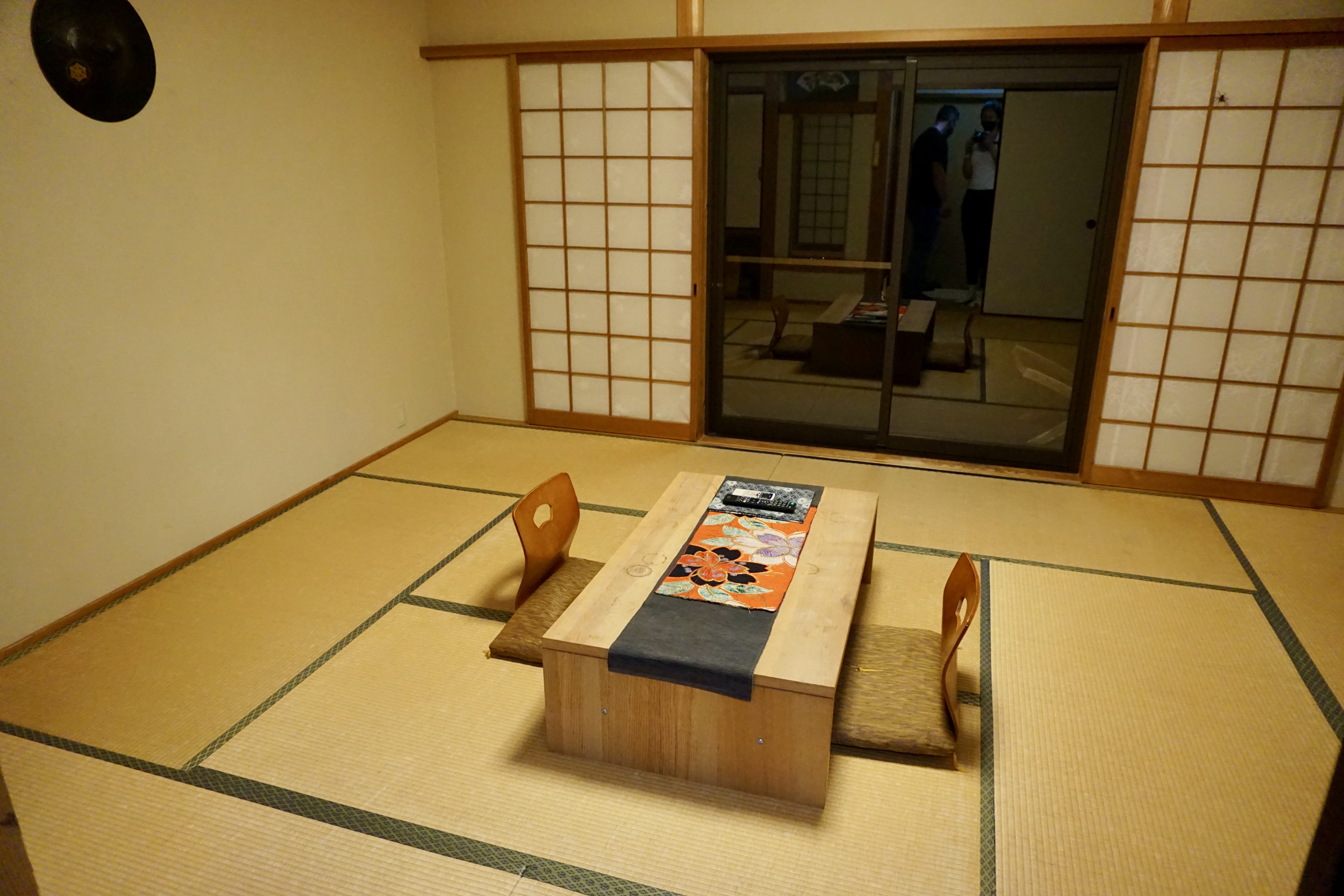
Most accommodations along the Kumano Kodo are minshuku, or family-owned Japanese bed and breakfasts. Ryokans are also quite common in the hot spring towns. A ryokan is a traditional Japanese inn with tatami-matted rooms, communal baths and kimonos available to wear during your stay. Both the minshuku and ryokans are a great way to meet and socialize with locals and learn more about Japanese culture.
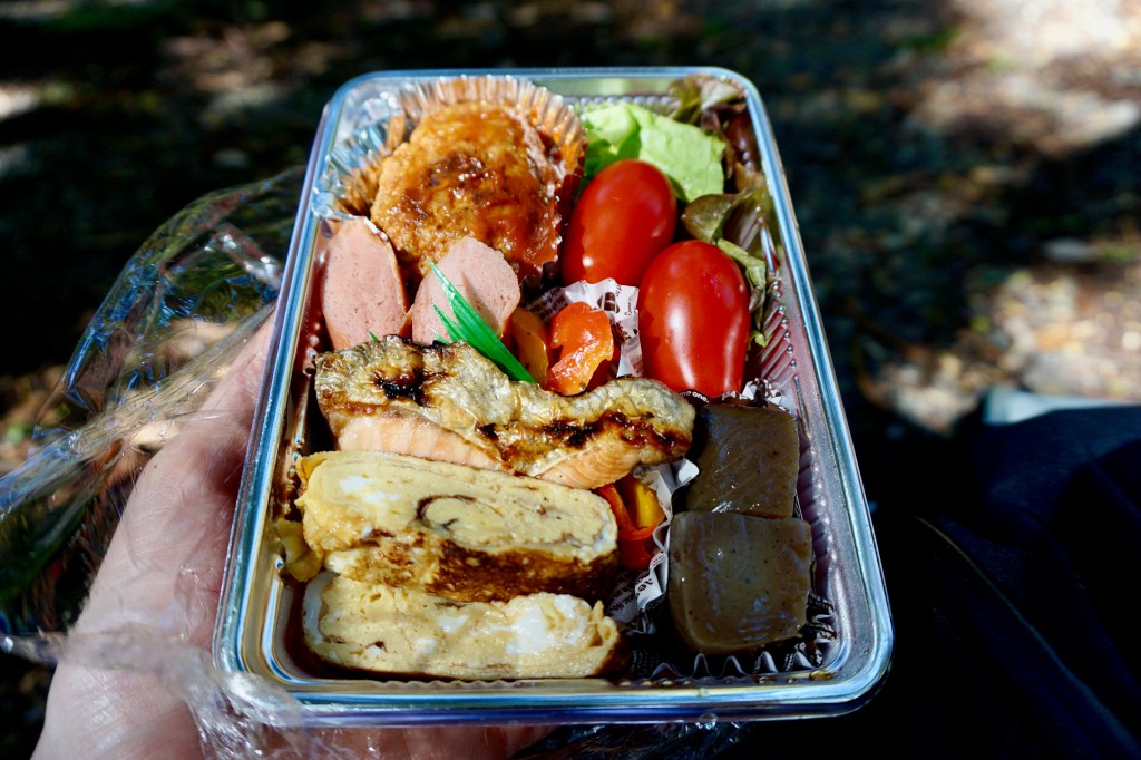
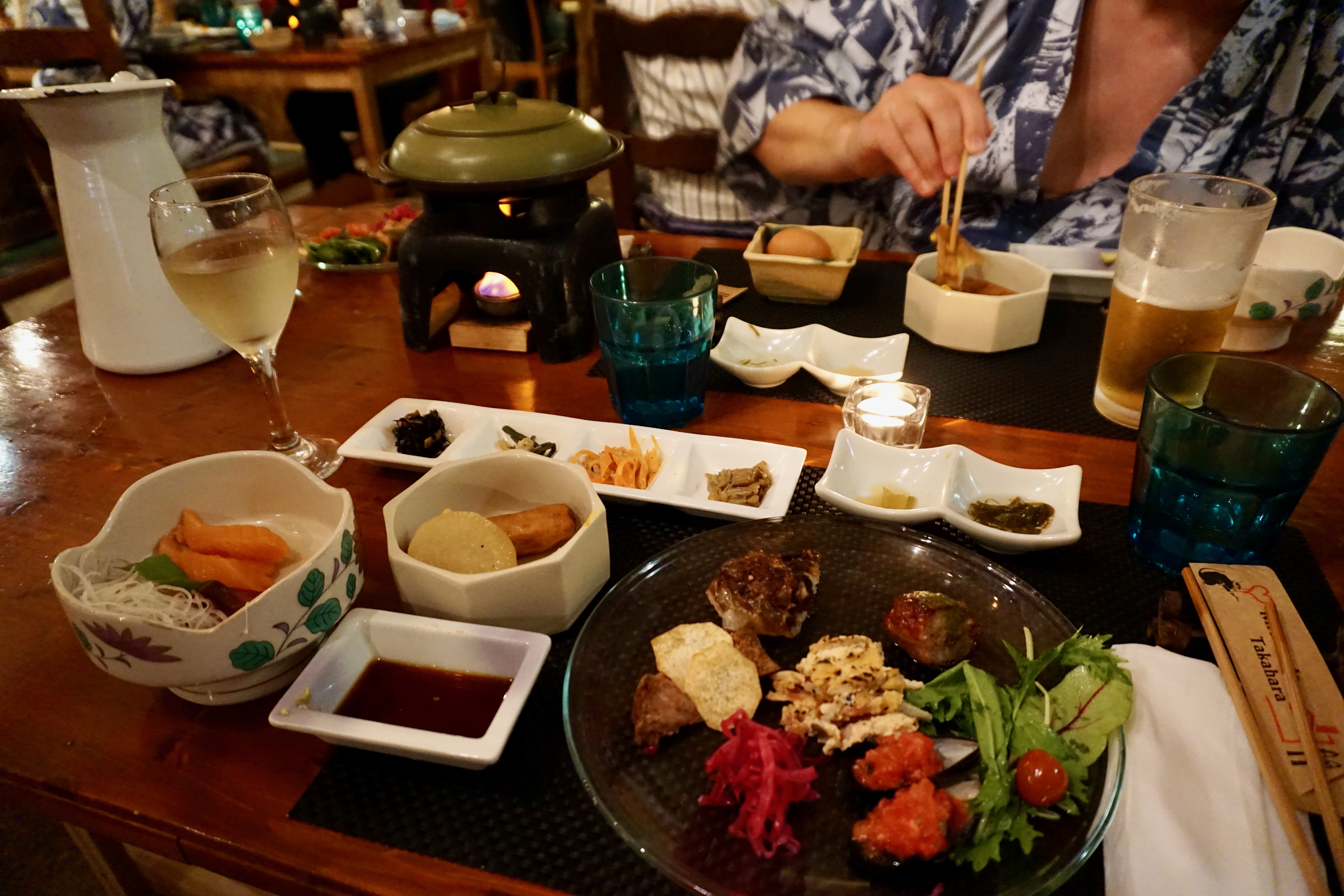
Typically included with your stay is dinner and breakfast the following morning. You can also add on a packed lunch for the following day’s hike. I highly encourage taking advantage of the food at these guesthouses as it was incredible and plentiful at every place we stayed! Truly, it was delicious, homemade, traditional Japanese cuisine that far surpassed my expectations.
Booking accommodations for the Kumano Kodo are done through the Kumano Travel website. The guesthouses along the Kumano Kodo share a reservation system to make things easier for both the pilgrims and the hosts. You can split up the hikes in many different ways, including adding bus stops to shuttle you to/from your lodging for the night or staying at lodging that is along the hike. Also optional is a luggage transfer service to transport suitcases from place to place so that you need only carry essentials on the trail.
My Trip Along the Nakahechi Route
DAY 1: TAKAJIRI-OJI TO TAKAHARA
~2.8 miles and 1,341 feet of elevation gain
At the start of day one, we took a train from Osaka to Tanabe where we grabbed lunch and walked around the water before catching the bus to Takajiri-oji, the start of the Kumano Kodo. This section of the trail is very rugged and gains a lot of elevation early on. Along the way, we stopped at each oji to get our stamps and enjoyed seeing how each was unique in design.
That evening, we stayed at Kiri-no-sato Takahara Lodge. I can only say good things about this traditional ryokan. Our room was very cosy and the onsen (communal bath) was soothing and refreshing after a long hike. After bathing, we dressed in traditional Japanese kimono and had a homemade dinner in a large dining room with pilgrims from all over the world. The owner, Jian Shino, was born in the area but spent much of his youth in England and Spain. He treated guests during dinner by playing Flamenco music on his own guitar. This was a very special and unexpected treat for me after having lived in Spain for five months many years ago! We ate and talked with other pilgrims for several hours this evening and it was absolutely magical.
DAY 2: TAKAHARA TO TSUGIZAKURA-OJI
~ 7 miles and 1,976 feet of elevation gain
On the morning of day two we were lucky enough to witness the Kumano Kodo Picture Scroll Procession which occurs on November 3rd in Takahara. Participants dress in Heian Period costumes for this event and walk along the Kumano route for a small distance.
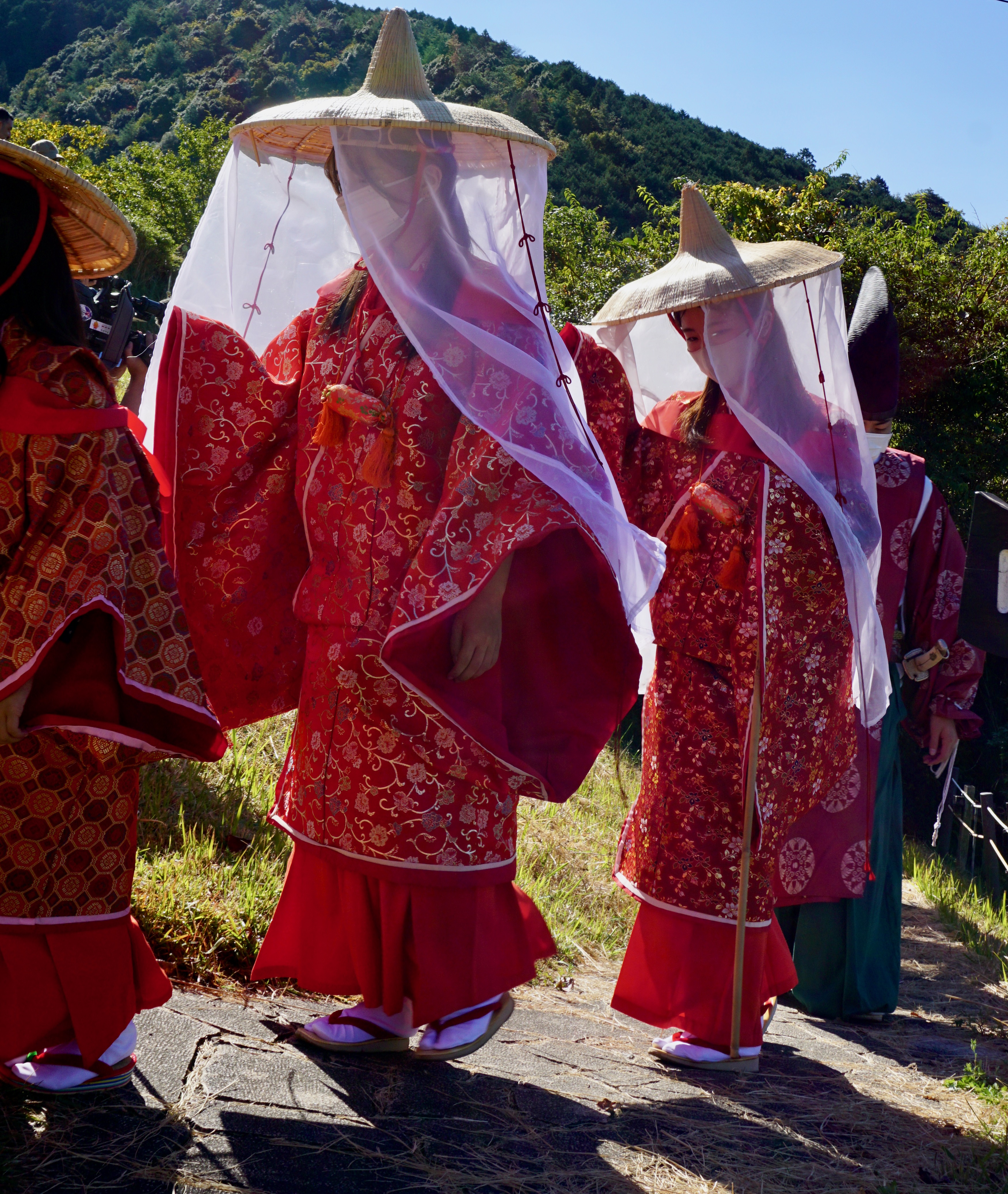
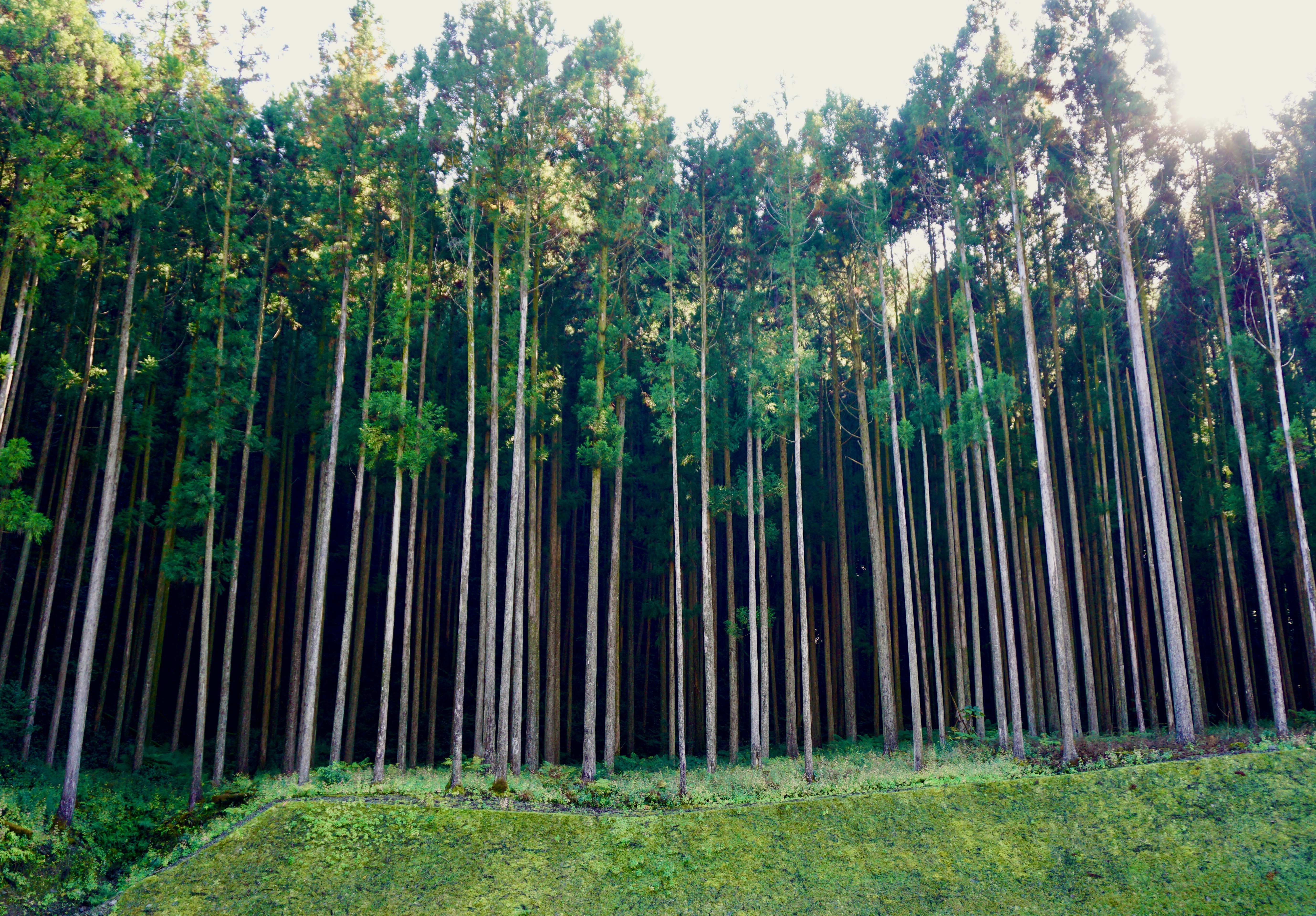
After the morning procession we made our way through dense forests and walked through small towns as we got closer to Tsugizakura-oji.

DAY 3: TSUGIZAKURA-OJI TO KUMANO HONGU TAISHA
~15 miles and 3,583 feet of elevation gain
Day three was our longest day on the Kumano. We could have grabbed a bus to finish our hike early and stay in town that night. However, we would have needed to take the bus back to where we left the trail the next morning, and we decided instead to just finish our hike on day 3. There were 4.5 miles left, but we knew the rest of the route would be primarily downhill and flat at that point.
The terrain this day was similar to the previous days. We did have a high mountain pass to go over that allowed for views above the tress. The air also changed here from what felt a bit more humid on one side to more arid on the other. Even the trees exhibited a noticeable change between the two sides of the mountain. In a few areas, we passed by the stone remains of abandoned, dilapidated homesteads that have been overrun by the forest.
At the end of our hike, we arrived at Kumano Hongu Taisha. I was overcome with awe upon arriving at this beautiful shrine after having hiked three days to reach this point. Since it was late in the afternoon and we needed to catch the last bus of the day to Yunomine Onsen where we would stay for the night, we snapped just a few pictures knowing we’d return in the morning.
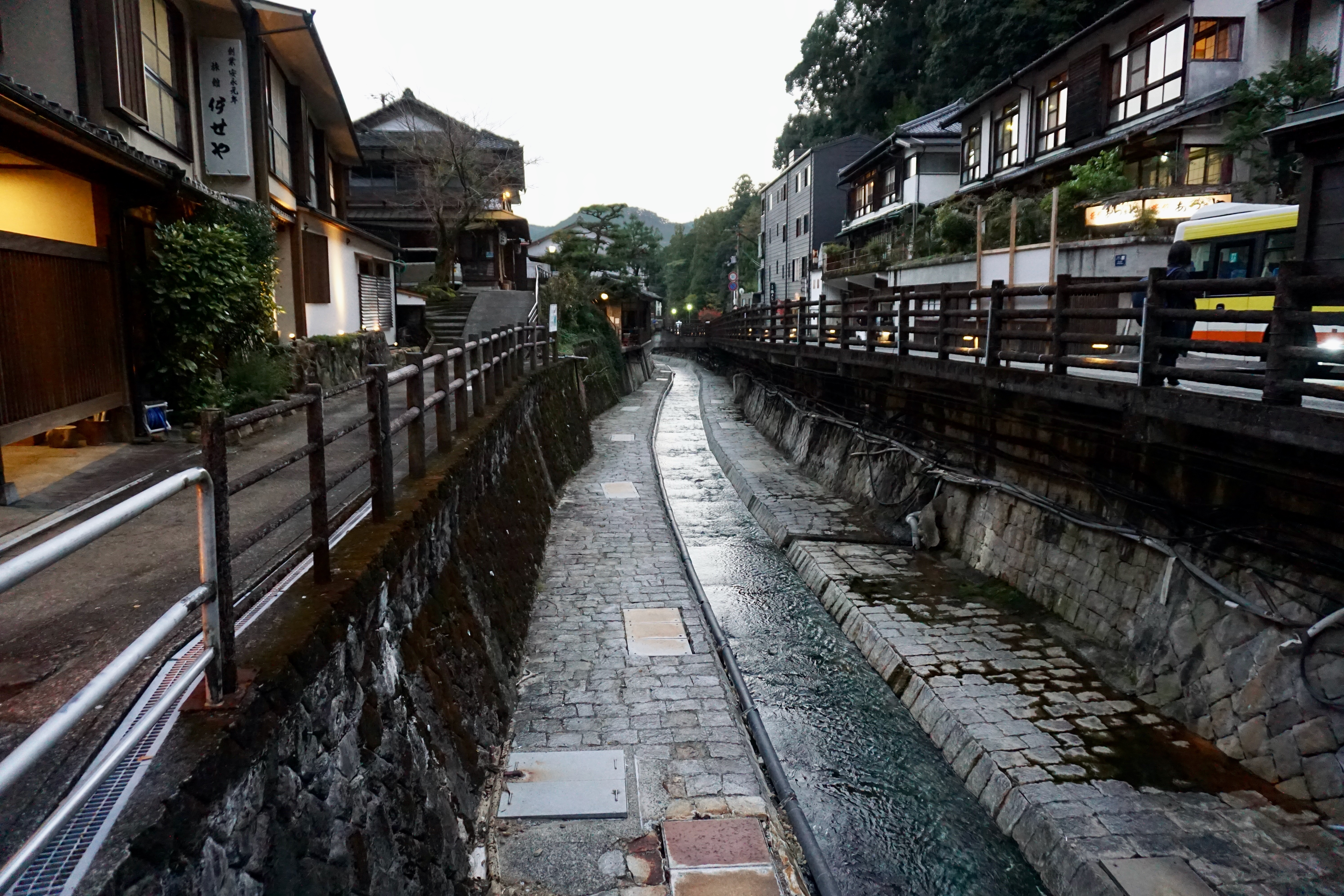
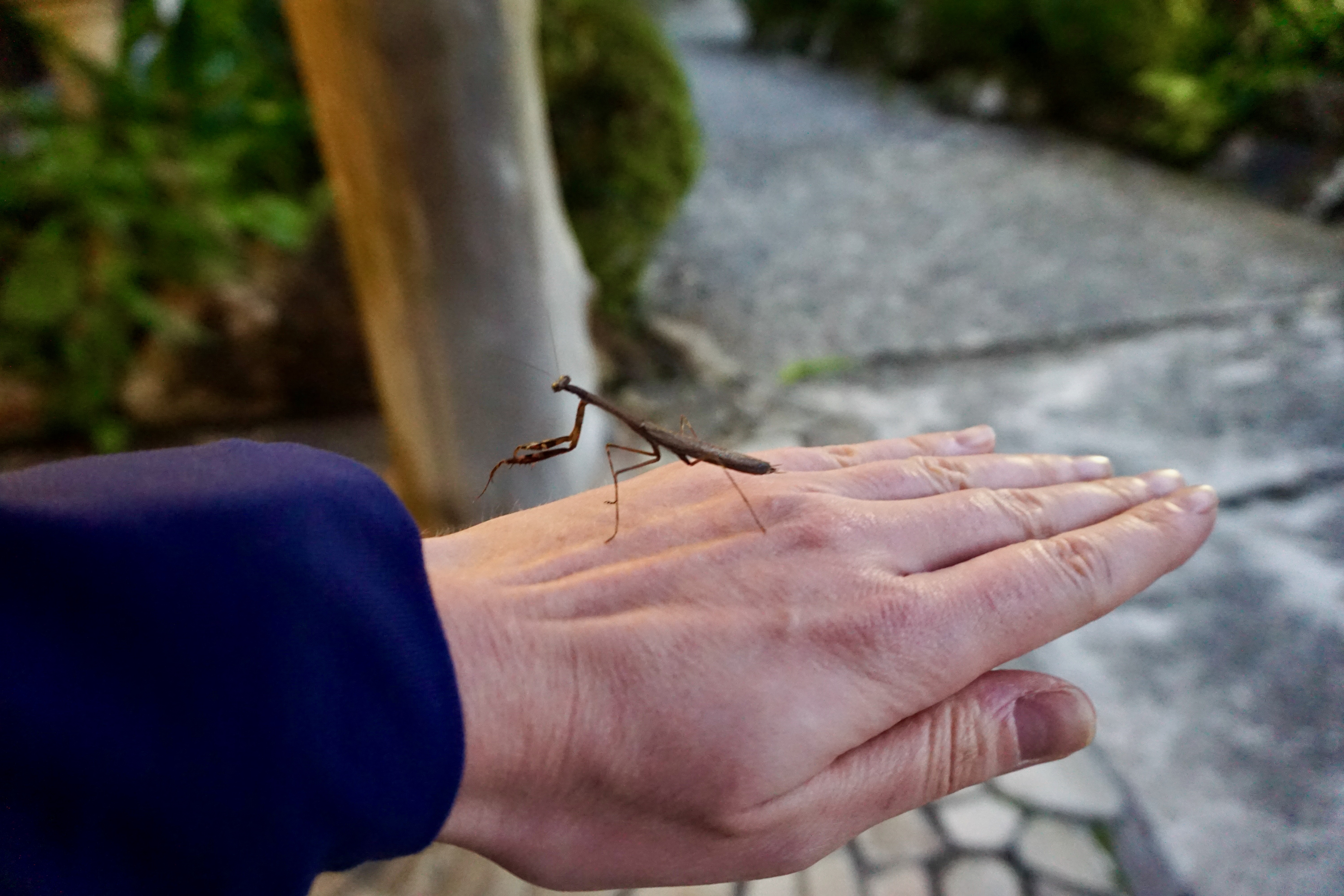
Yunomine Onsen is a quaint hot spring town in a narrow valley that I recommend staying at for an evening. Do be aware that restaurants are hard to come by here, but most of the lodging provides dinner for their guests on-site. At our ryokan, I was greeted by a praying mantis on the floor of the lobby, which gladly hopped on my hand for a lift back outside. Its presence felt like a small blessing and a fitting end to our last day on the Kumano Kodo.
DAY 4: VISITING KUMANO HONGU TAISHA AND KUMANO HAYATAMA TAISHA
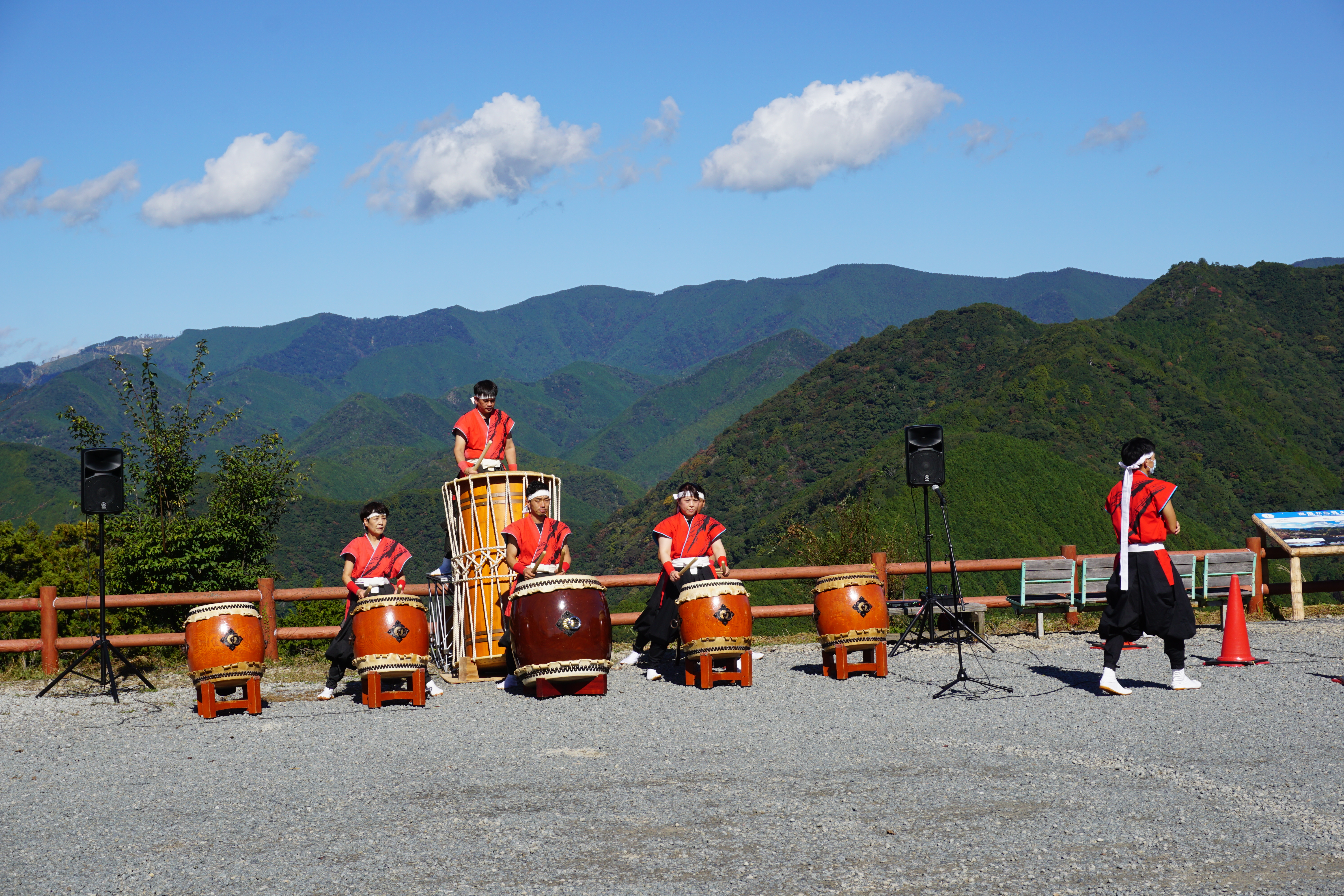
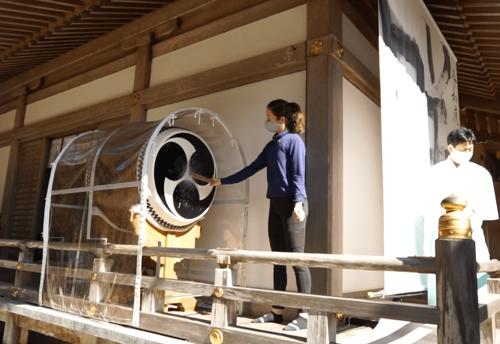
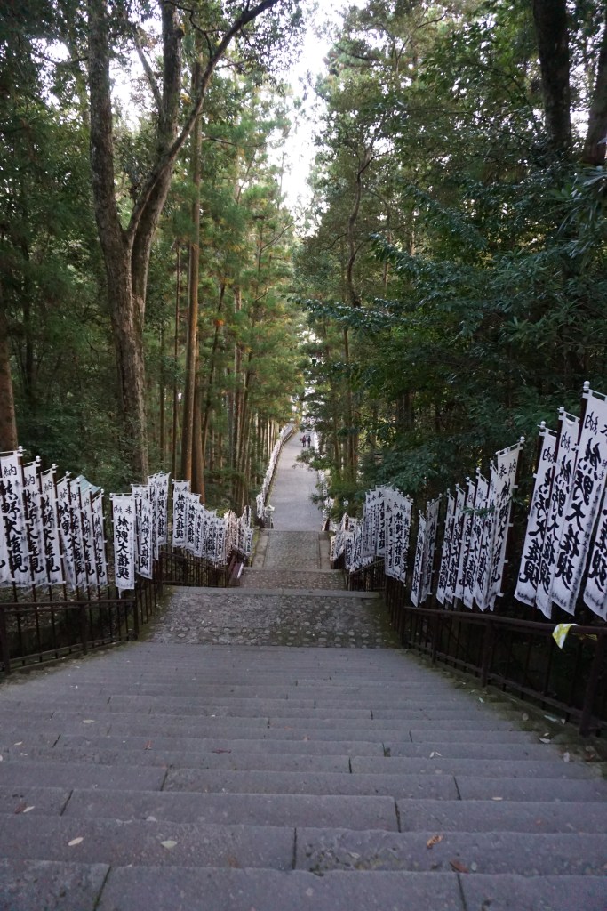
After a relaxed morning and some breakfast, we boarded a local bus to take us on the short road back to Kumano Hongu Taisha. Passing the prayer flags and climbing the steps to reach the shrine, I was nervous and excited for the Dual Pilgrim Taiko Ceremony, which involves drumming on the sacred Taiko and receiving our certificates.
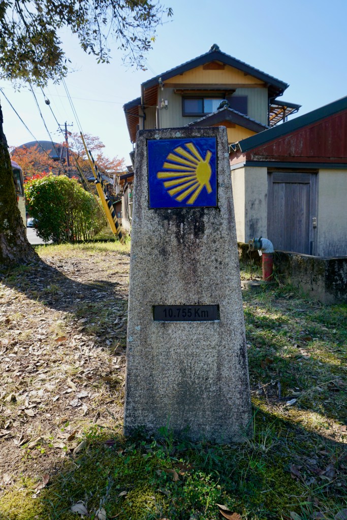
This scallop shell distance marker near the tourism center was a fond memory of the Camino de Santiago.

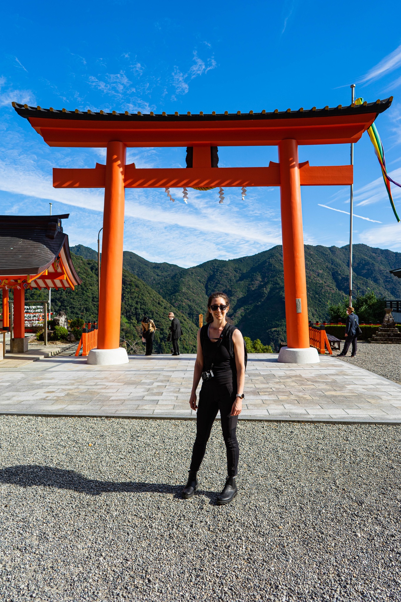
After visiting Kumano Hongu Taisha, we went to the Grand Torii Gate down on the river bank. This Torii is the largest in the world at 33.9 meters tall. The area on the other side of the gate is Oyunohara, the historical location of the Kumano Hongu Taisha shrine. In 1889 a flood destroyed much of the shrine complex and it was rebuilt in 1891 in its present location using materials from the wreckage a bit further away from the river bank.
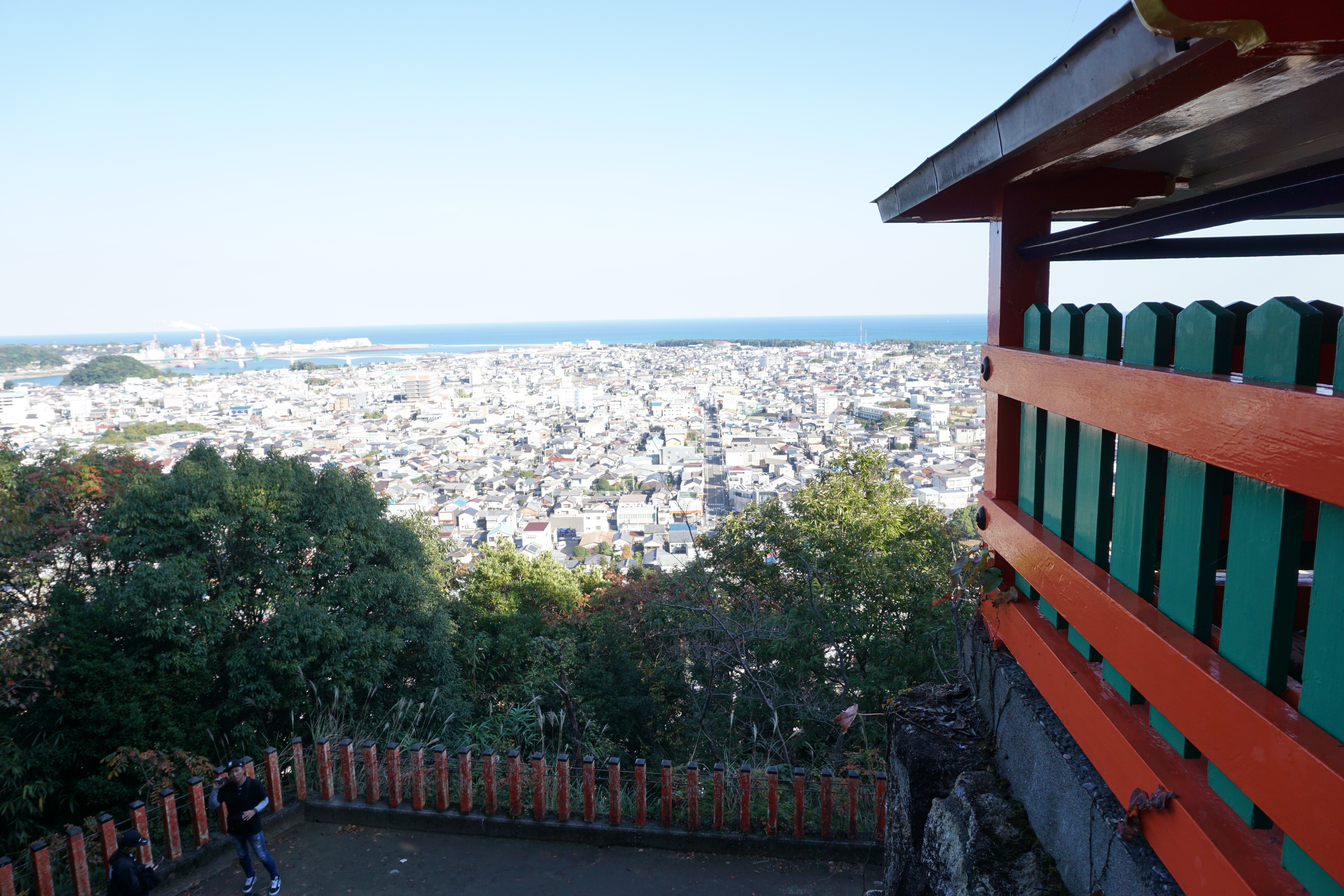
Afterwards, we took a bus east to Shingu where we visited the second Grand Shrine, Kumano Hayatama Taisha. From there, we walked south along the western edge of town until we came upon the large, steep, stone staircase climbing up to the Kamikura Shrine on the mountain face overlooking Shingu. It is here that a small shrine was built next to a large, sacred boulder perched on the mountainside named Gotobiki-iwa. We then hopped a train down to Katsuura to spend the night near the third and final shrine.


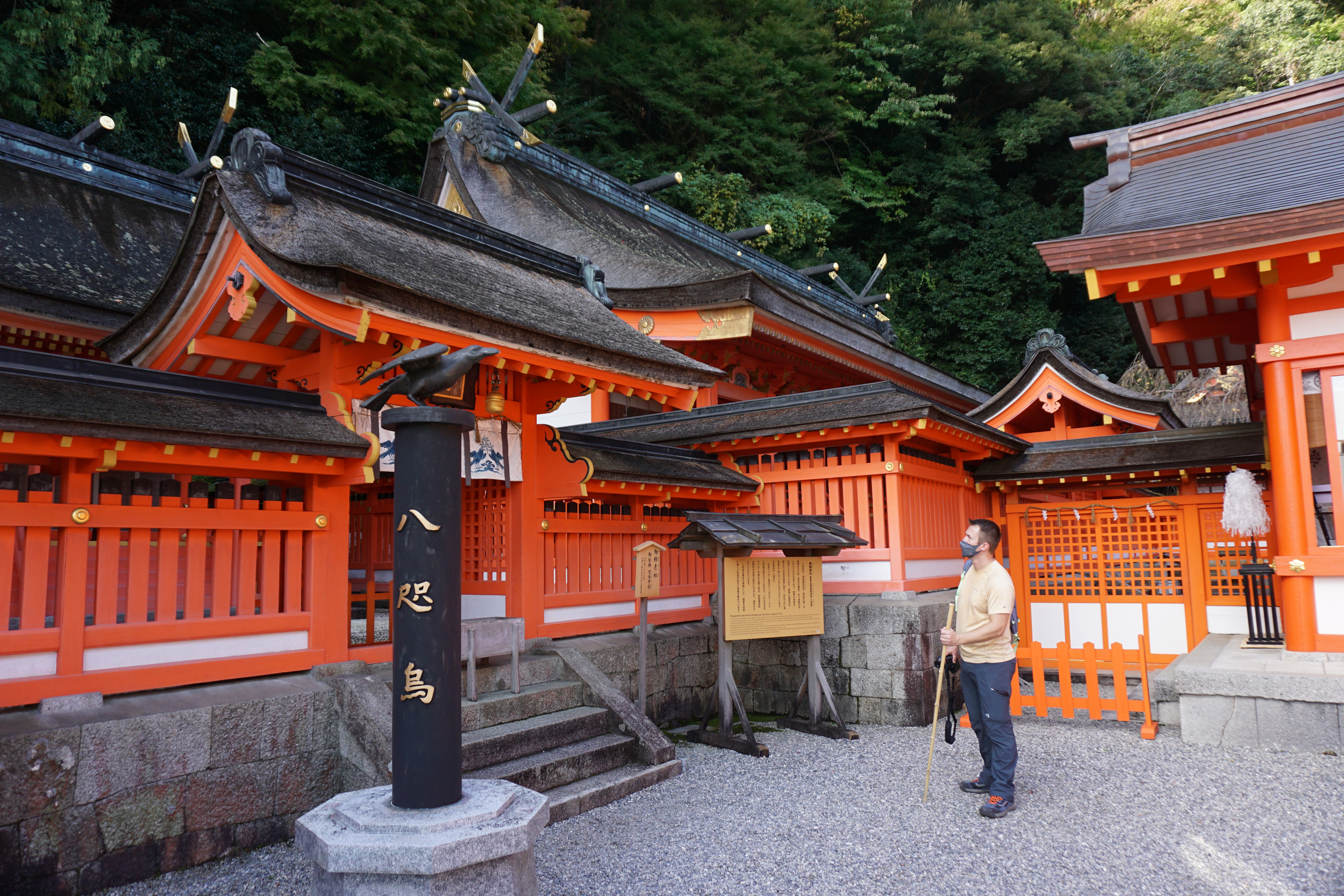
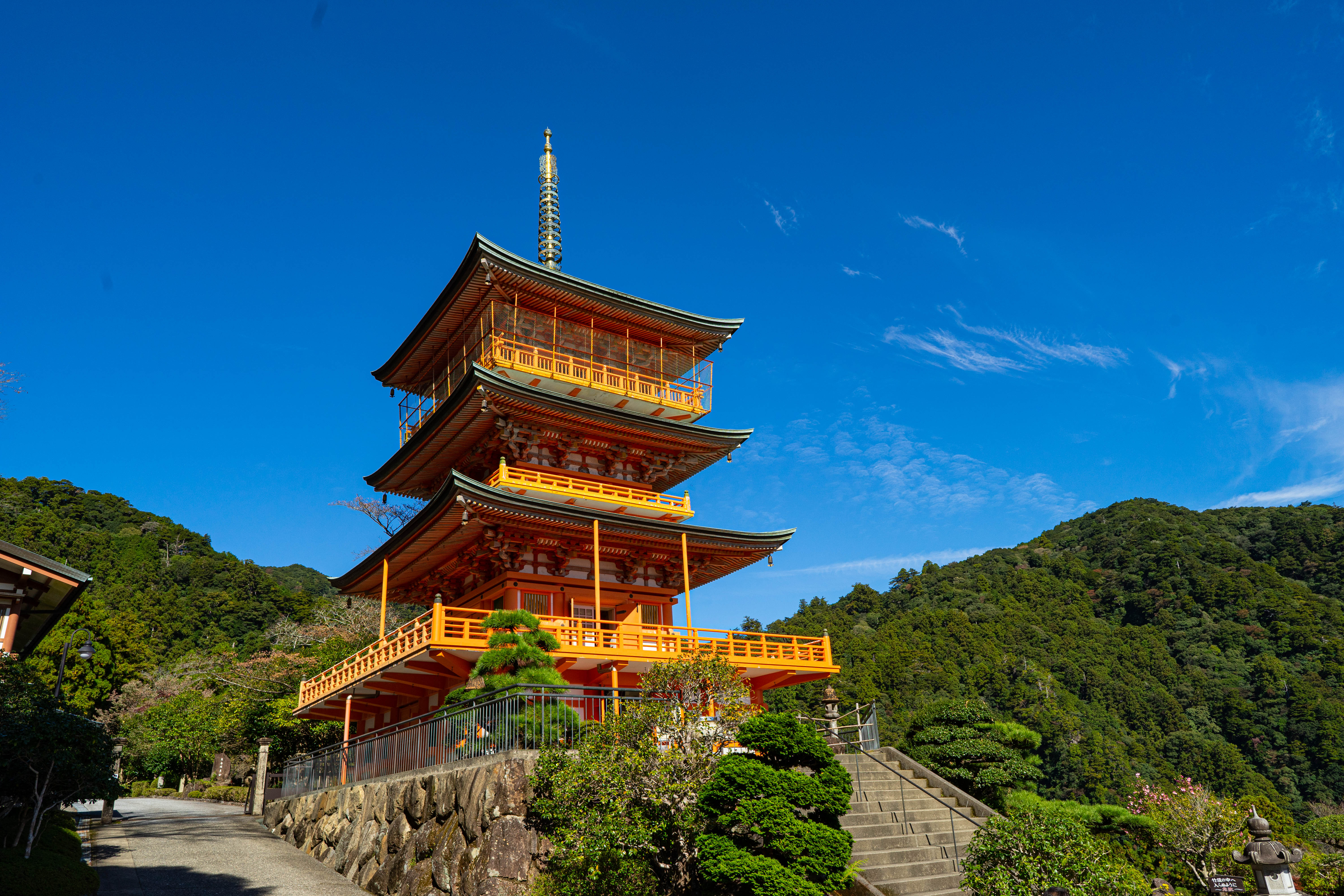
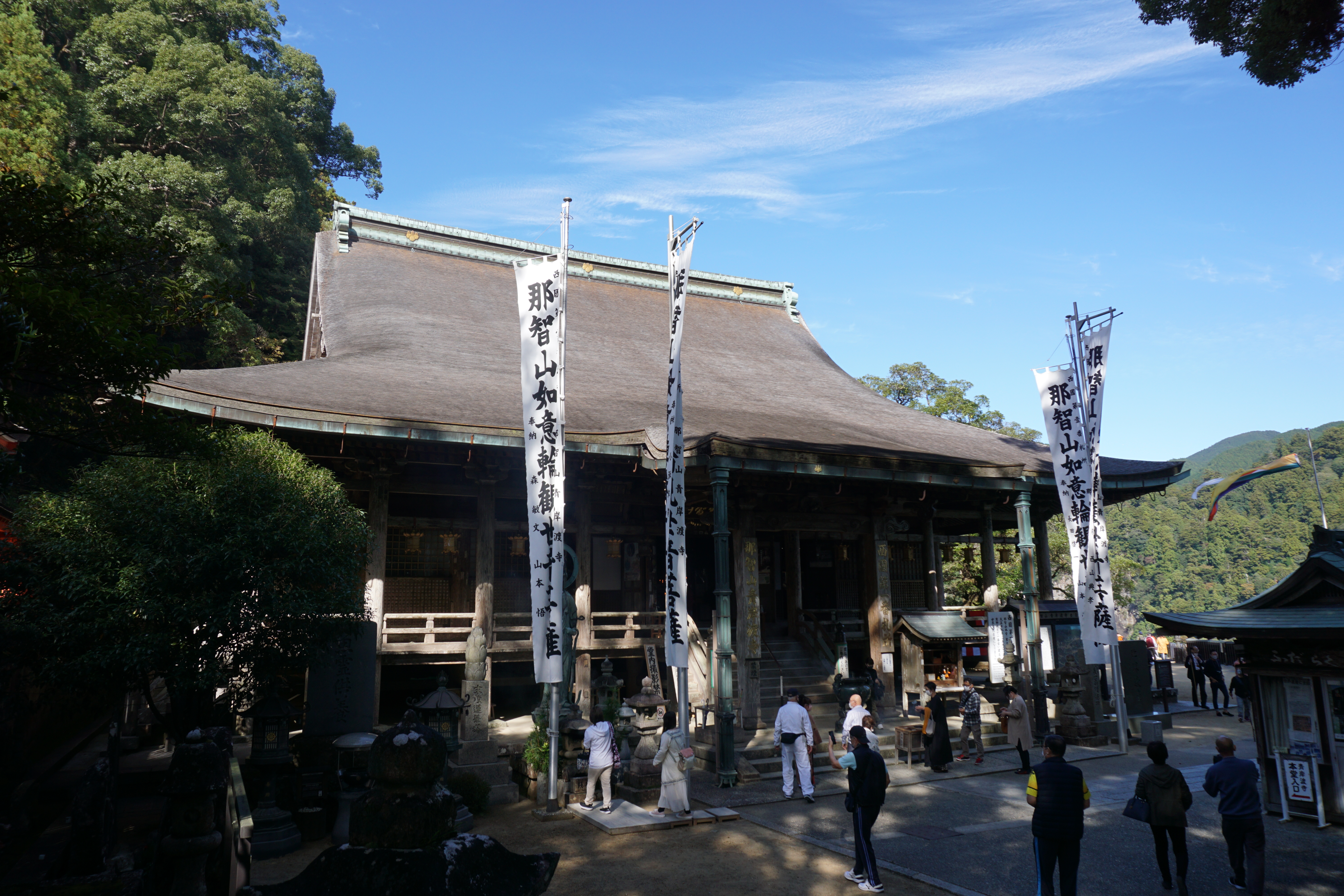
DAY 5: KUMANO NACHI TAISHA SEIJANTO-JI AND NACHI FALLS
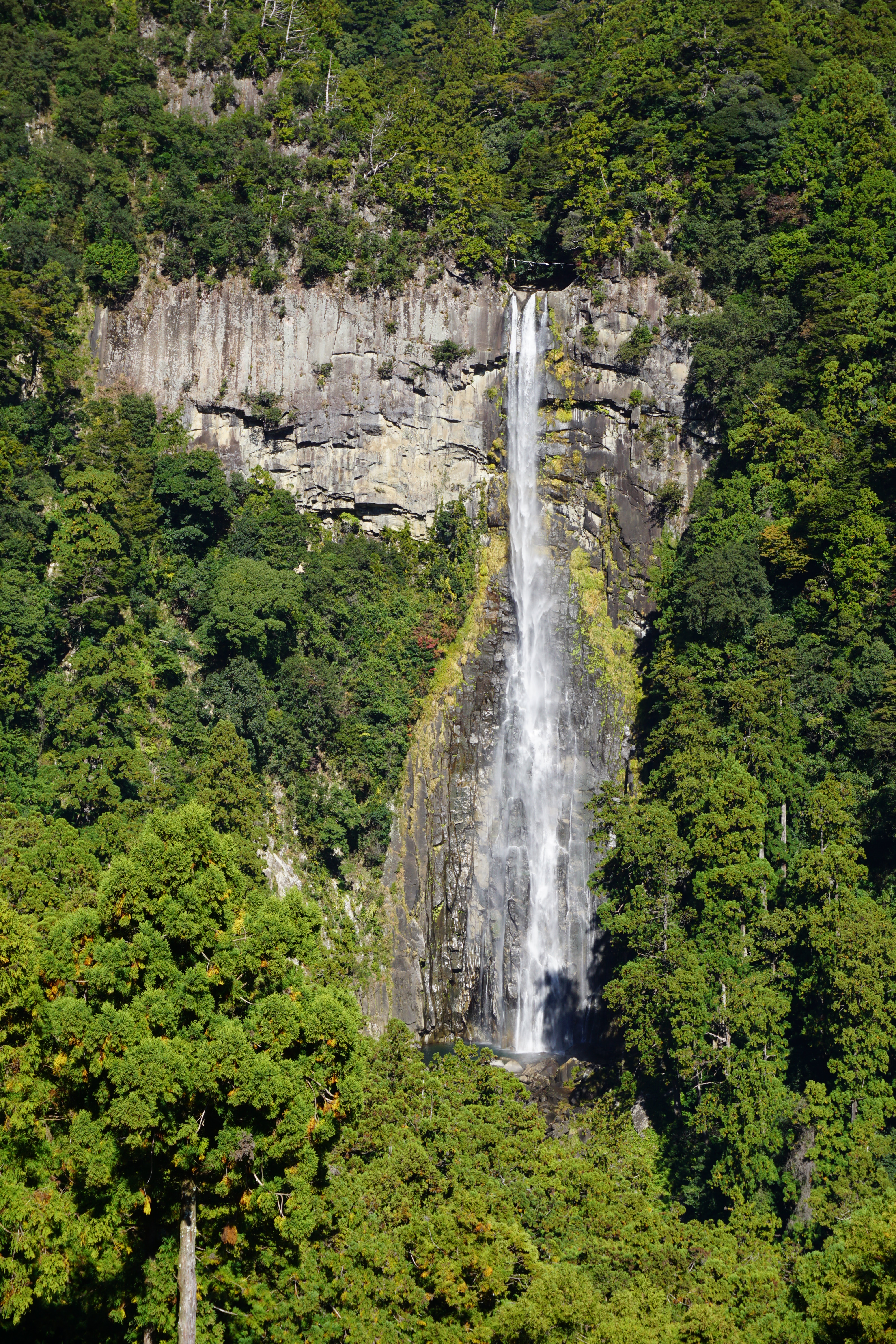
On our last day we got up early and caught the bus up to Daimonzaka. Once we arrived, we hiked uphill through a grove of massive ancient cedar trees lining the walkway leading to the last of the three Grand Shrines: Kumano Nachi Taisha. This shrine is unique in that it has a Buddhist temple, Seijanto-Ji directly next to it, which is also a UNESCO World Heritage Site. Just north of the temple is a bright red three-story pagoda overlooking Nachi Falls. This waterfall is the highest single-drop waterfall in all of Japan and is a very well-known spot for photographers capturing both the pagoda and waterfall in one scene.
After exploring a bit and hiking down to the base of the falls, we made our way back up to the bus stop to Katsuura. We grabbed some to-go lunches at the convenience store, said our final farewell to the Kumano Kodo and then hopped on the next train bound for Osaka. Although the train ride back is long (4+ hours), the scenic coastal route takes you around the southern edge of the Kii peninsula where countless beaches, fishing villages and orange tree groves can be viewed from the windows.
Have you been on the Camino de Santiago or Kumano Kodo? Comment below on your experience!

Leave a comment