The Oregon coastline is stunning with its tall, jagged rocks jutting out of the water and thick stands of trees lining the fine sand. I had never been to Oregon before, but as I was researching multi-day cycling trips, information on this route came up and I was immediately struck by its beauty. Since I was in between jobs with a month off and had a friend who also found herself in the same situation, we both decided this would be the perfect trip for us. And so that was it! The idea to cycle the Oregon Coast was hatched and we immediately set out to plan the trip.
What is covered here:
The Route
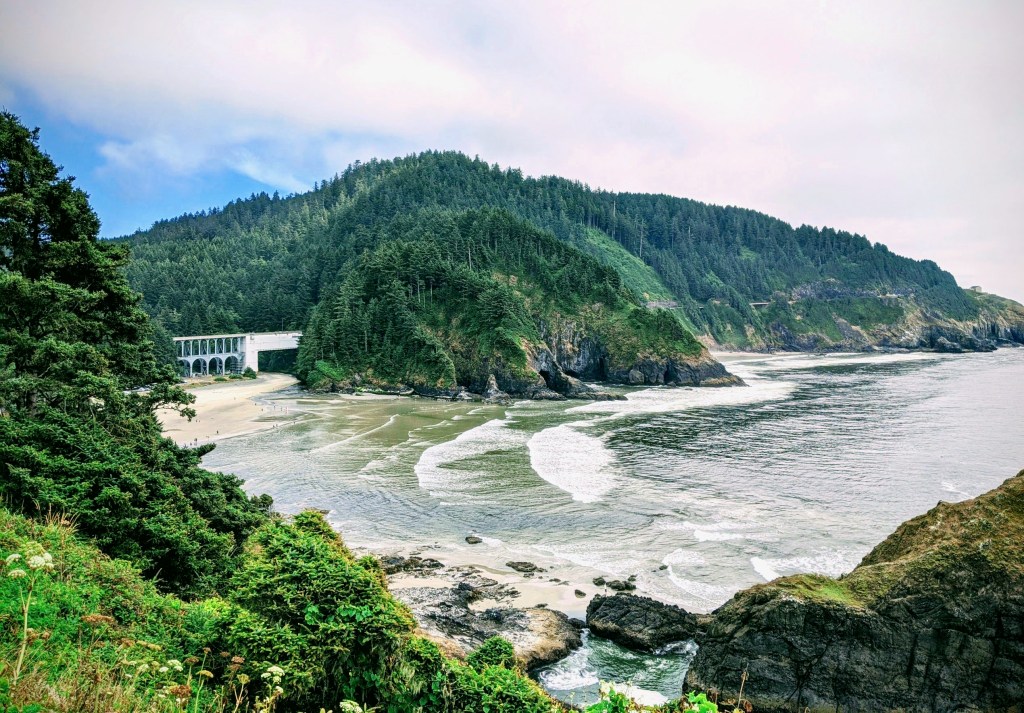
The Oregon Coast Bike Route, or OCBR, follows Hwy 101, starting in Astoria, Oregon and ending in Brookings, Oregon. It is approximately 370 miles long with 20,000 feet of elevation gain. Yes, that’s right, 20,000 feet! This is not a flat and easy ride as one might expect when following the coast. It is hilly and at times quite steep, but this makes for some fun and speedy downhill segments! The best time of year to go is August through October, when temperatures are warmer, rainfall and traffic is lower, and the coastal winds are blowing south. The recommended direction to take therefore is from North to South to avoid strong headwinds.
As mentioned, the route not only follows Hwy 101, but is actually ON Hwy 101 for the majority of the trip. This means riding along with motorists most of the time and is the biggest (and only) downfall to this route. The shoulder can be quite wide at times and non-existent at other times. On average I would say the shoulder was 3 feet wide, which can still be a bit daunting. There are suggested off-shoots to the route as well as stretches where it will completely diverge from the highway (where it has been deemed absolutely unsafe to bike), but these are few and far between. Additionally, there are two tunnels that present an additional challenge on the route. These are the Arch Cape tunnel, a few miles south of Cannon Beach, and the Cape Creek tunnel near Heceta Beach. These tunnels are long, dark and narrow. The Arch Cape tunnel has a narrow sidewalk that can be used to get off the road, but the Cape Creek tunnel does not. Be sure to use front and rear lights when in these tunnels, as well as the button shortly before entering the tunnels that can be hit to light up a flashing signal to alert motorists that a cyclist is in the tunnel.
Note: In 2022, an OregonCoast Bike Route Plan was adopted to address some of the higher risk sections.
Amenities
There is a plethora of well-kept campgrounds along the route as well as grocery stores, gas stations, restaurants and rest stops. Many campgrounds have hiker/biker sites that are first-come first-serve and very inexpensive. Water can be found in many places so there will be no need to carry a lot with you. To decrease weight, my friend and I chose not to bring cooking equipment, and instead grabbed food to-go or picked up a meal from a grocery store along the way. That being said, be sure to plan out your food stops in advance so you don’t reach your campground and realize the closest food stop is five miles back the way you came.
Our Itinerary
We had planned to break the trip up into ten days, with eight cycling days and two rest days. However, my friend developed tendonitis in her Achilles tendon, which required taking an extra rest day and skipping over one of our cycling days in order to keep our campground reservations.
Day 1: Astoria to Nehalem Bay State Park. Distance: 49 miles. Elevation gain: 2,400 feet.
For the first half of our first day on the route, we were biking through industrial cities and towns, and I grew a little concerned about how much coastline we were actually going to see throughout the whole trip.
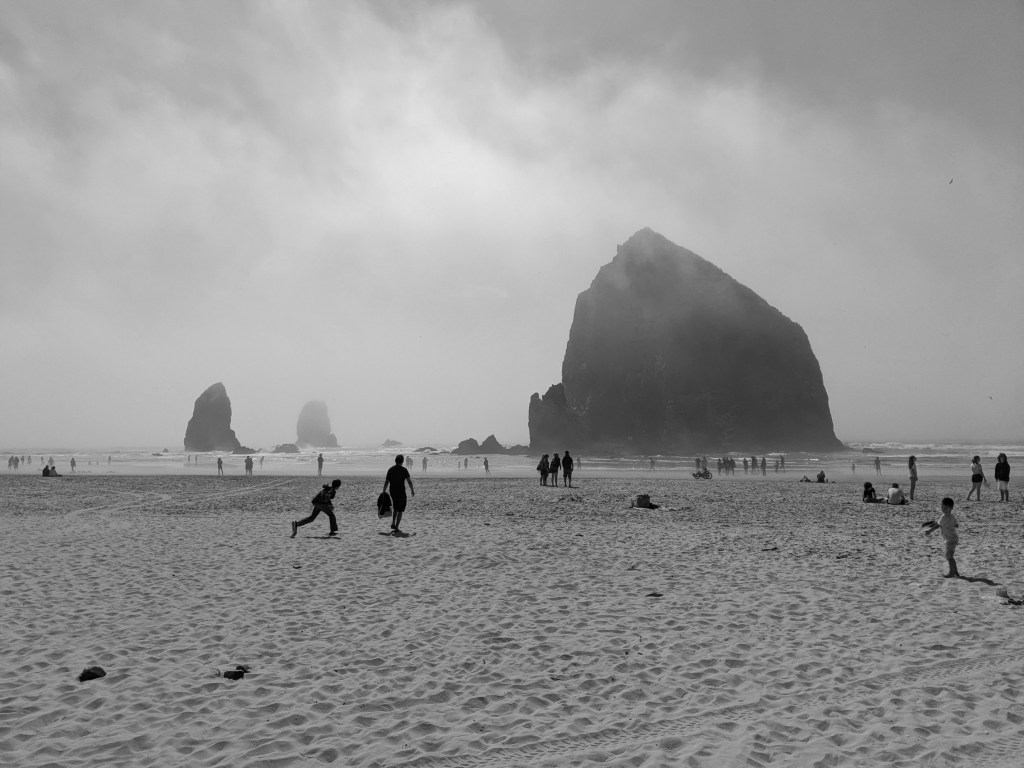
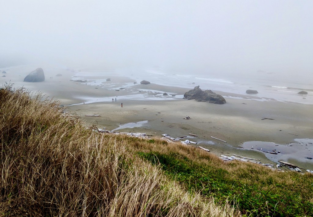
Fortunately, by the second half of the day we finally joined up with the coast and were met with beautiful views that were everything I had imagined and hoped for. This included Haystack Rock at Cannon Beach, which is an ideal spot to take a lunch break. The campground we stayed at at Nehalem Bay State Park was a perfect end to the day as it was clean and right along the ocean, which made for a beautiful sunset.
Day 2: Nehalem Bay State Park to Sandbeach Campground in Sand Lake Recreation Area. Distance: 49.5 miles. Elevation gain: 2,480 feet.
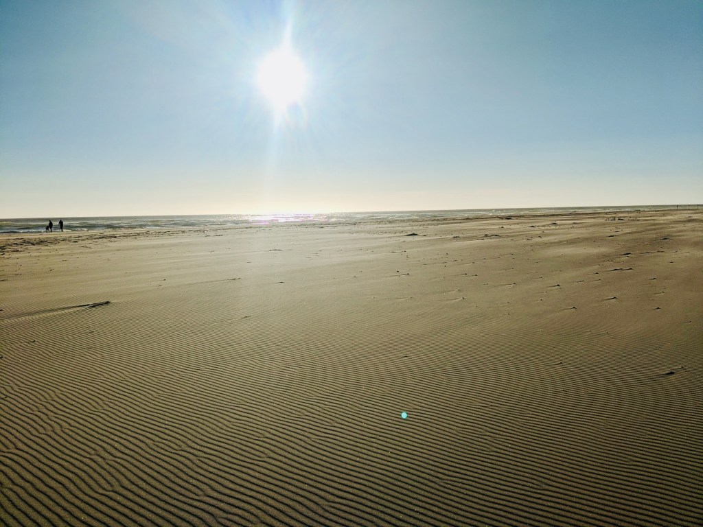
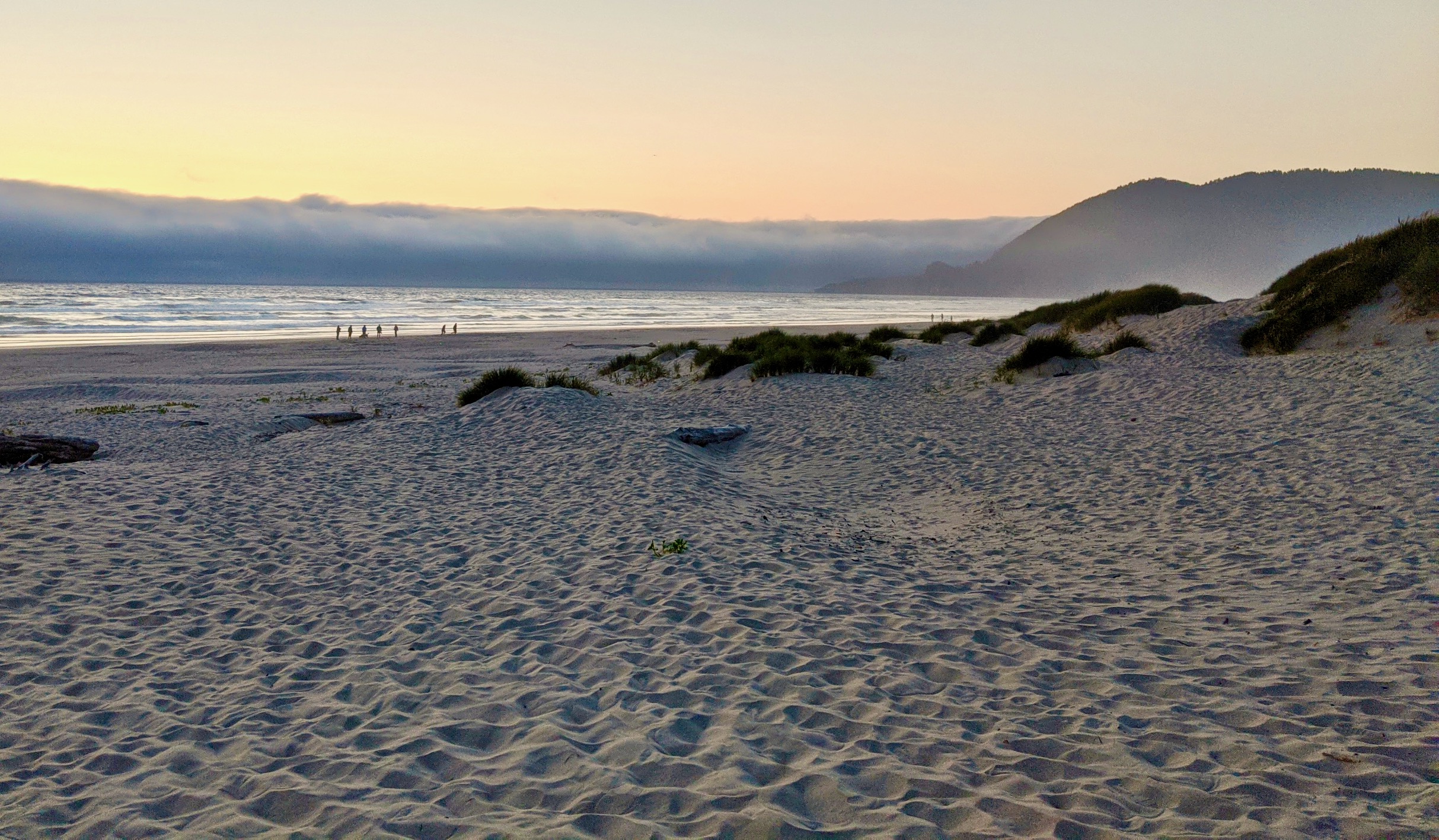
On day 2, we passed by the Tillamook Cheese Factory and took a break here to tour the factory and have some lunch with delicious local cheese and ice cream. After our break, we had planned to take the Three Capes Scenic Route but found out it was closed for construction. Instead, we took Hwy 131 to Netarts, Oregon and then continued south again from there. We stayed at Sandbeach Campground, which is a part of the Sandlake Recereation Area and sand dunes. This may have been my least favorite campground of the entire trip as it was noisy from the OHVs and less care was taken to keep the campground clean.
Day 3: Sandbeach Campground to Lincoln City. Distance: 32.5 miles. Elevation gain: 1,860 feet.
On the third day of our trip, we stopped at Cape Kiwanda for lunch and to visit this beautiful Oregon State Natural Area. There are sand dunes here that one can hike to the top of to take in the views. We then continued and took the Slab Creek Road alternative to tour old-growth forest and farmland. That evening we stayed in a hotel in Lincoln City in order to get a good night’s rest and to wash clothes, which we did by hand in the bathtub.
Day 4: Lincoln City to Cape Perpetua. Distance: 52 miles. Elevation gain: approximately 1000 feet.
Unfortunately, my friend had developed tendonitis in one her Achilles after the last three days of cycling and so we decided to skip this segment of the trip, take a rest day and stay another night in Lincoln City.
Day 5: Cape Perpetua to Jessie M. Honeyman Memorial State Park. Distance: 31 miles. Elevation gain: 1,985 feet.

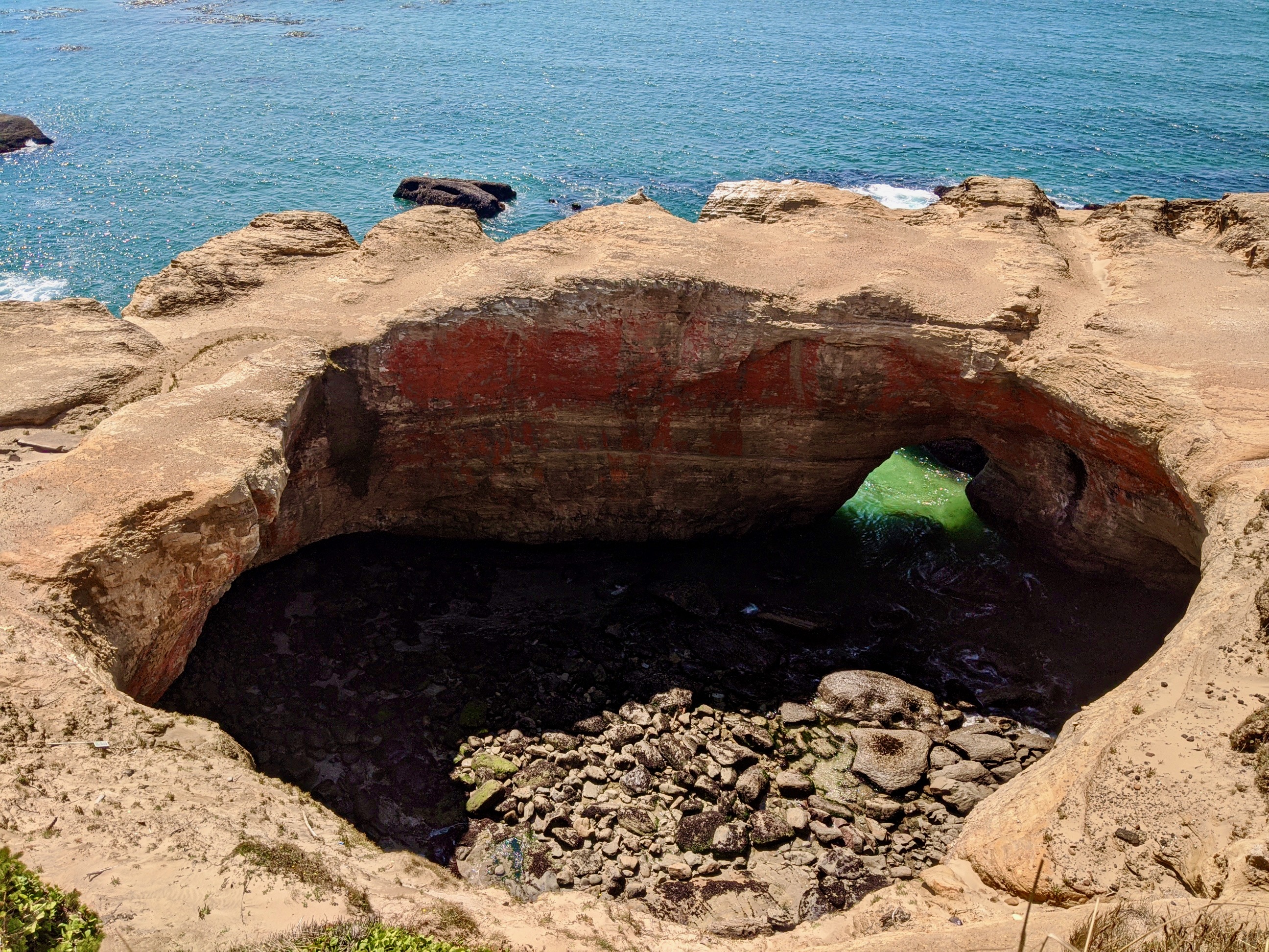
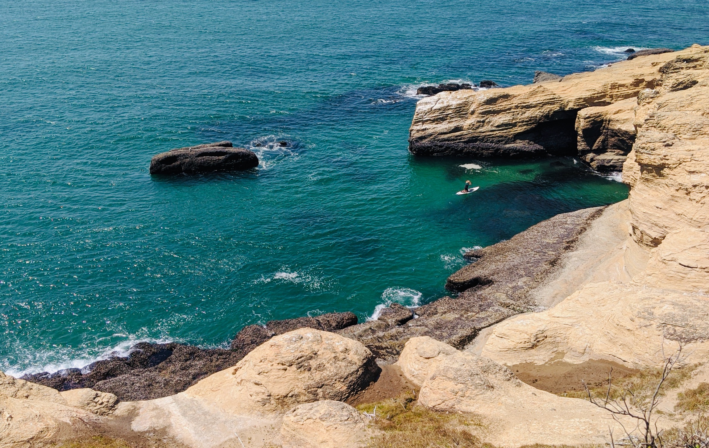
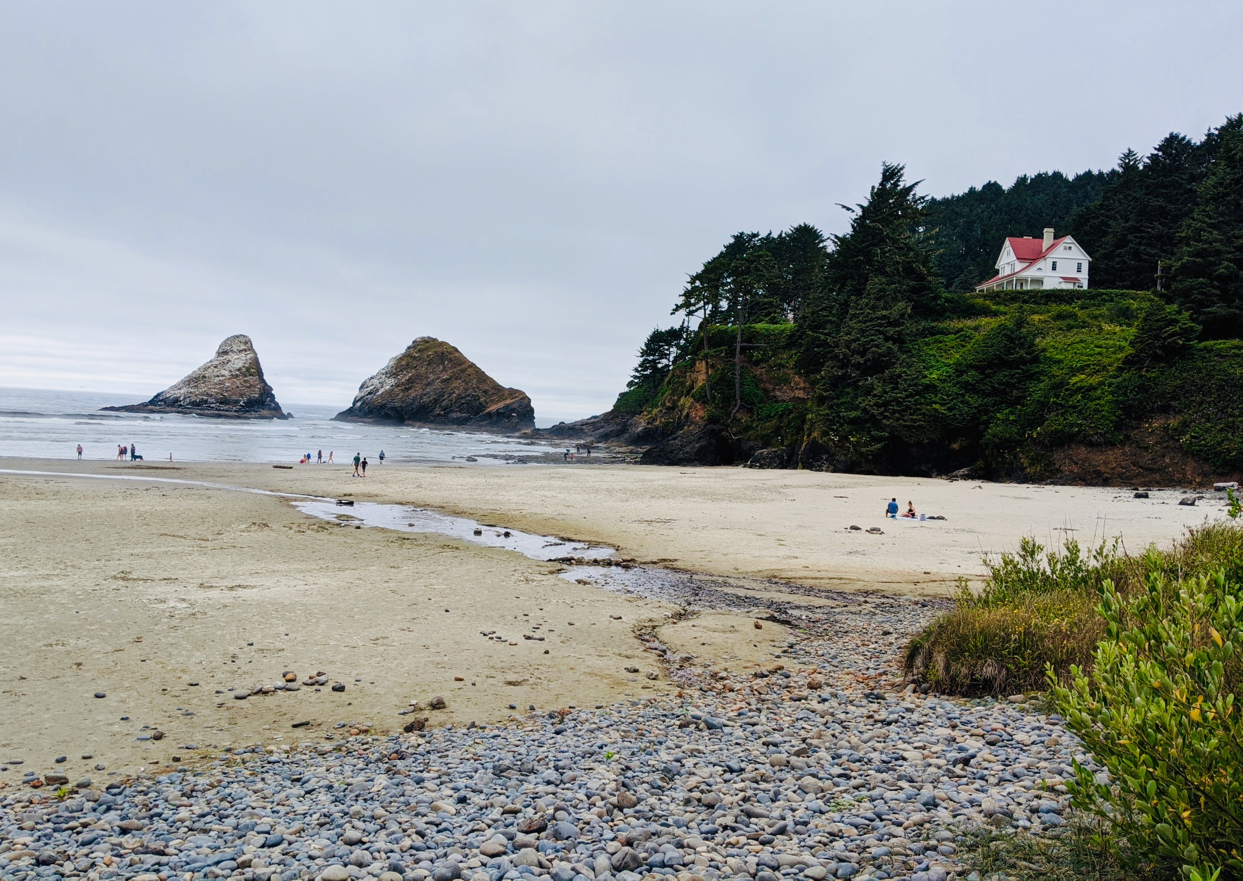
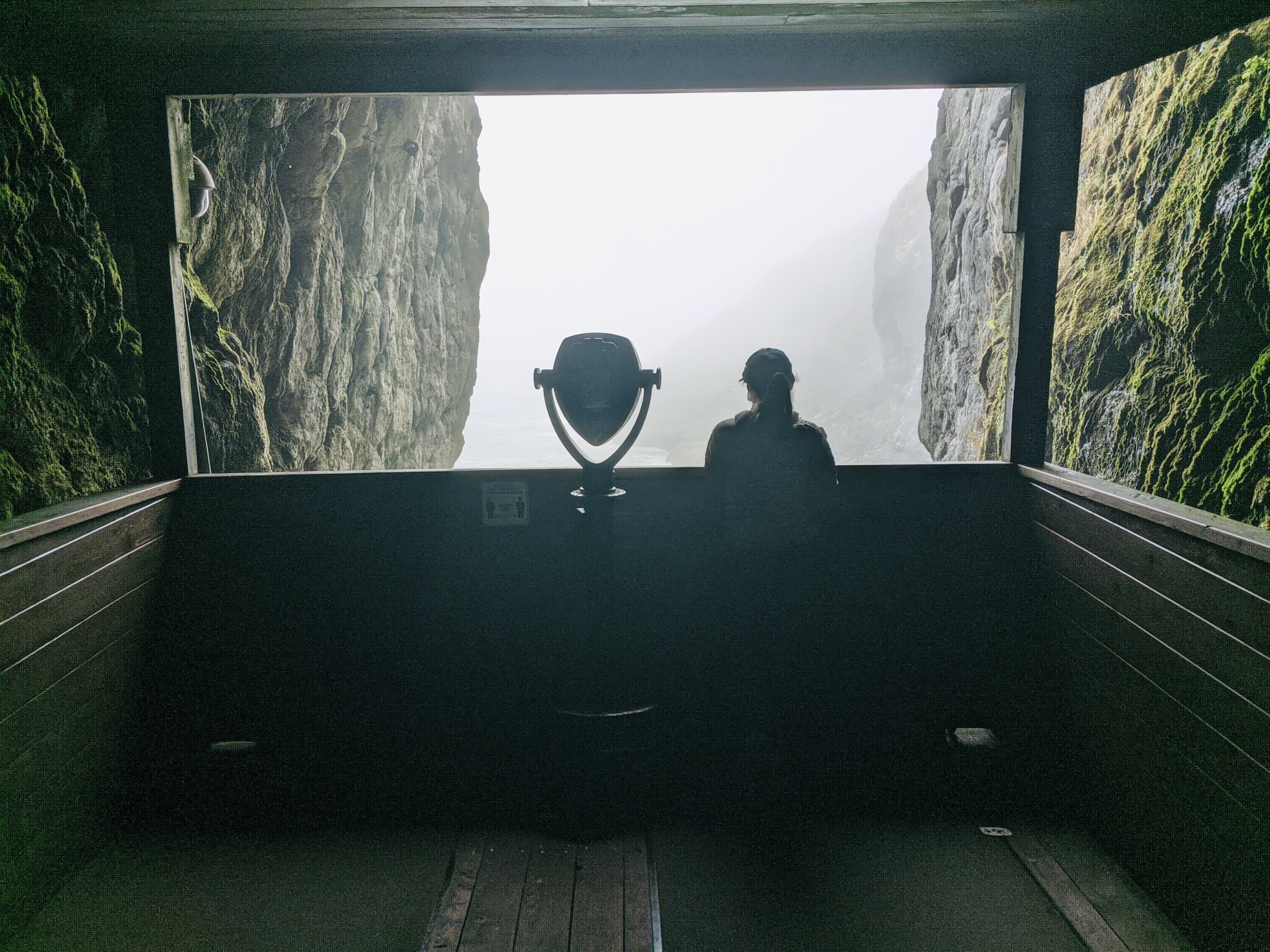
We caught a ride to Cape Perpetua and then continued cycling again from there. There were a lot of great places to stop and see on this day, such as Devil’s Punchbowl State Natural Area, Thor’s Well, Heceta Head Lighthouse and the Sea Lion Caves. Pictures of the first three are above (can you spot the paddleboarder in the above photos?).
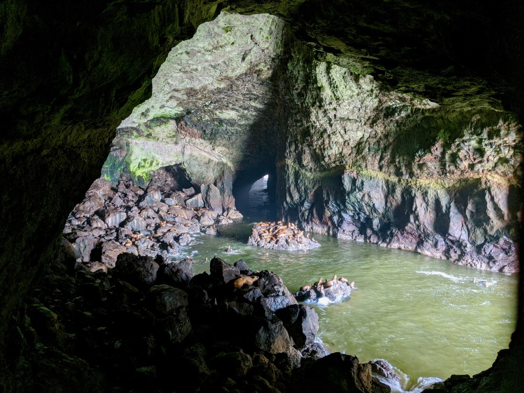
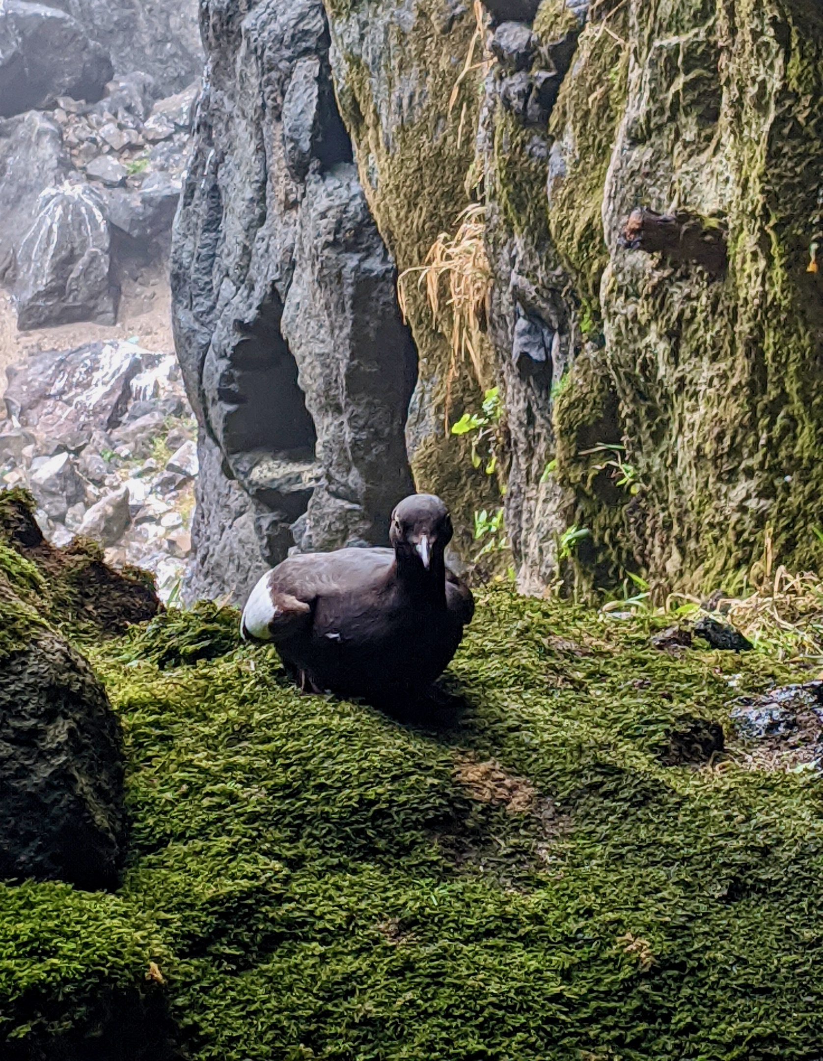
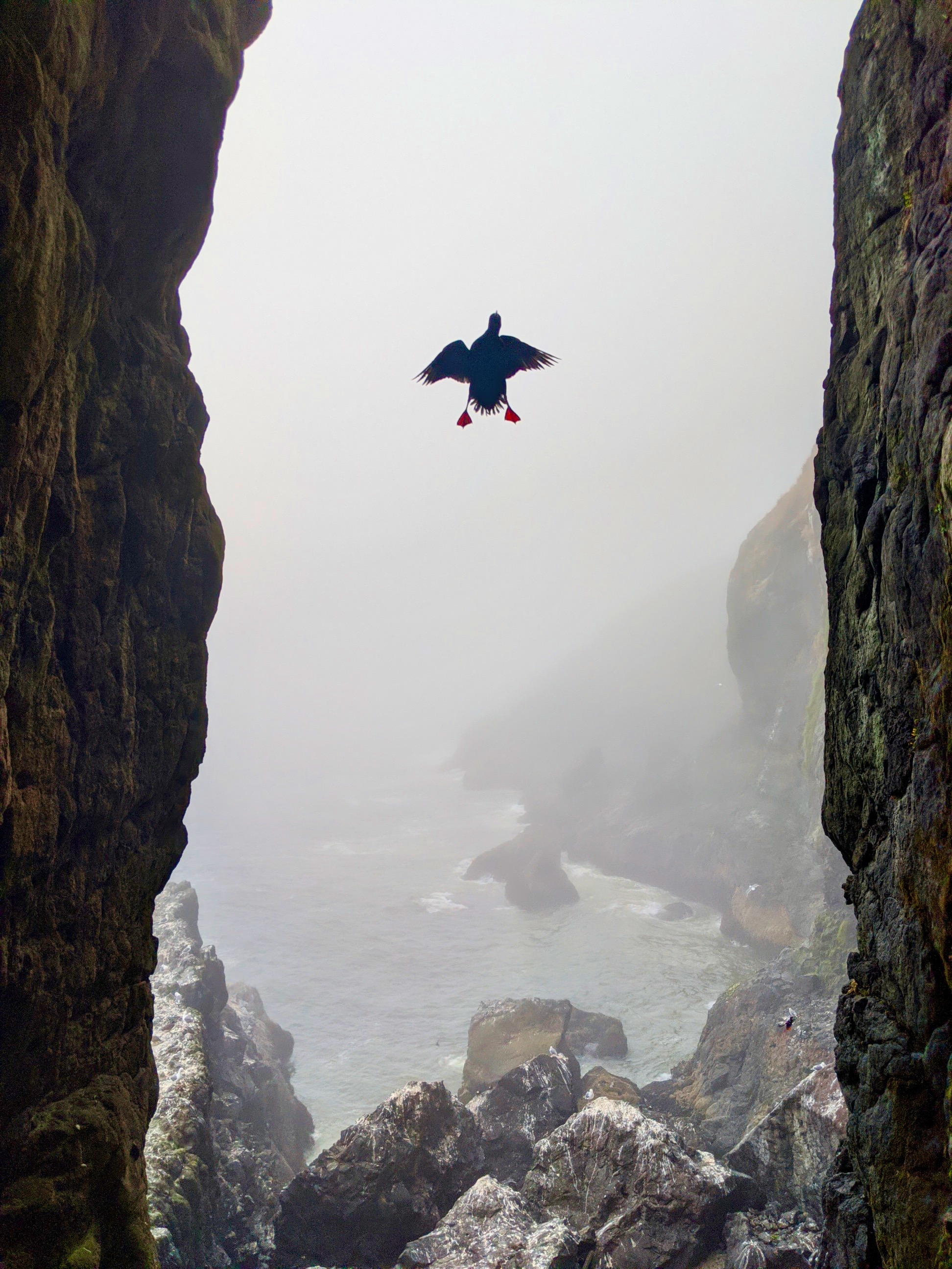
We were initially on the fence about going to the Sea Lion Caves, but ended up really enjoying this place. You take an elevator down to a massive underground cave filled with sea lions, and can also see a nesting area for pigeon guillemots. I had never seen this species of bird before, so was very happy to have the chance. I loved their orangish-red feet!
Day 6: Rest day!
Day 6 was another rest day, and we took the opportunity to rent ATVs and cruise around the sand dunes at the Oregon Dunes National Recreation Area.
Day 7: Jessie M. Honeyman Memorial State Park to Bluebill Campground. Distance: 41 miles. Elevation gain: 1,994 feet.
On day 7 we took the Winchester Bay alternative route through an old fishing village where we stopped for fish and chips at lunch time. We stayed at Bluebill Campground which was a less scenic campground than others we had tried.
Day 8: Bluebill Campground to Bullards Beach State Park. Distance: 33 miles. Elevation gain: 2,006 feet.
On day 8 we chose to take the Seven Devils Road over hilly terrain with views of the Slough National Estuarine Sanctuary. The forested area through here was a nice change of view from the coastline. Despite its name, the Seven Devils Road was not as challenging as some other climbs on the Oregon Coast Route.
Day 9: Bullards Beach State Park to Humbug Mountain State Park. Distance: 42 miles. Elevation gain: 2,046 feet.
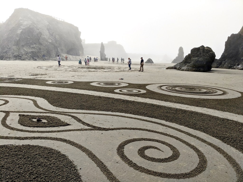
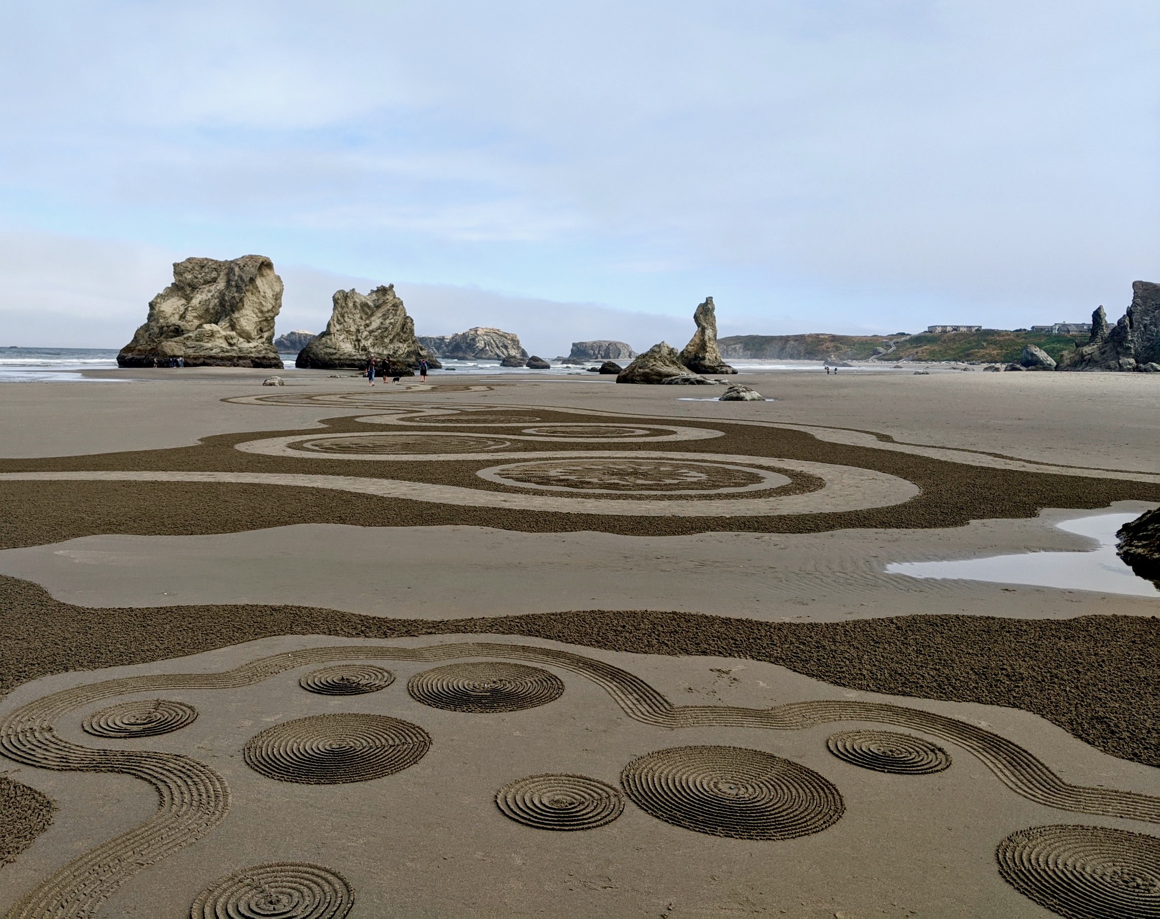
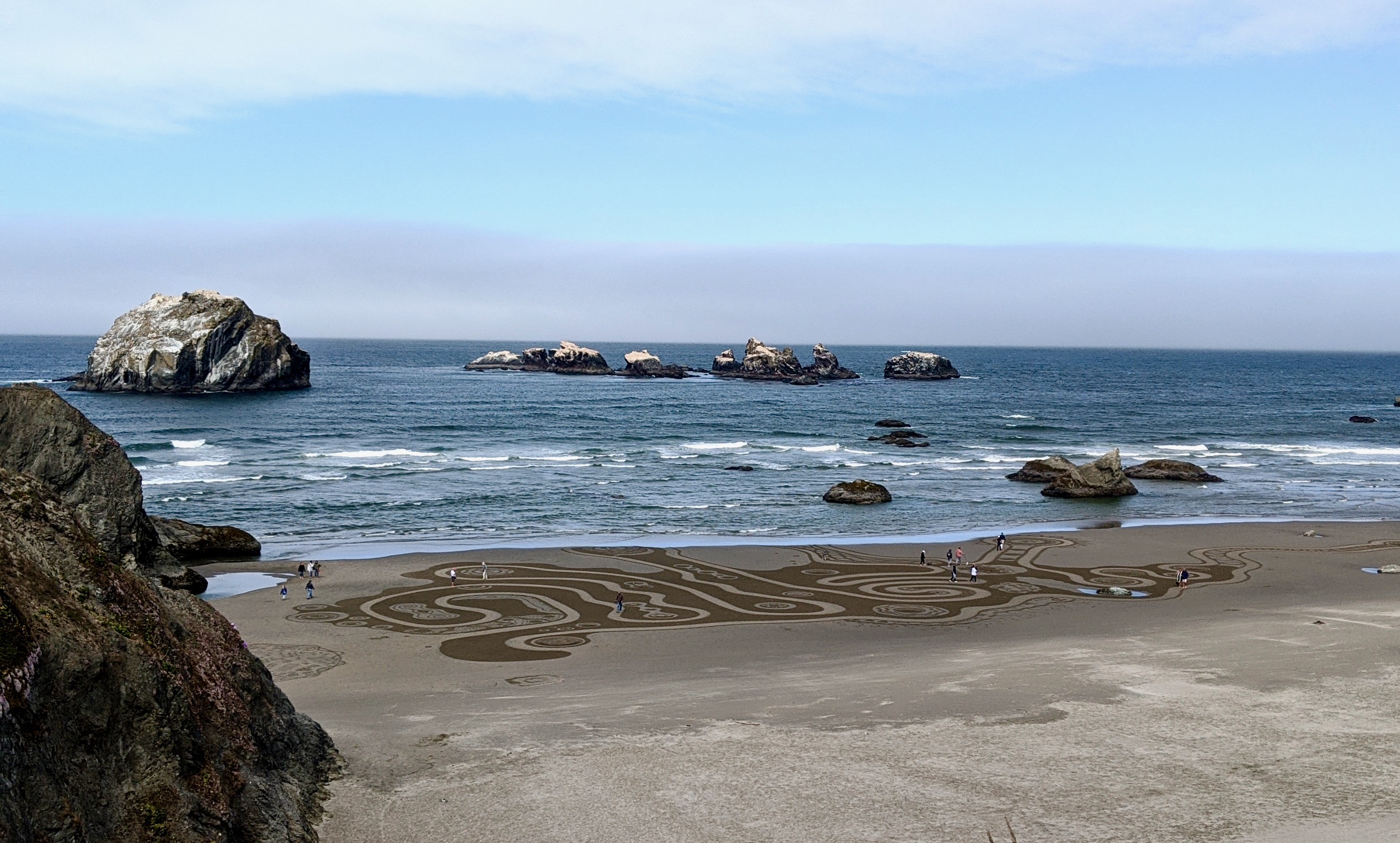
On our second to last day, we took the Bandon Bypass to avoid heavy traffic and had more terrific views of the coastline. Additionally, we were rewarded with sand art drawings at Face Rock Viewpoint. These drawings, or Circles in the Sand, were started in 2011 by a labyrinth artist. They can be seen at the end of April through early August. Check here for the schedule.
Day 10: Humbug Mountain State Park to AtRivers Edge RV Resort. Distance: 55.5 miles. Elevation gain: 3,383 feet.
And finally we’ve reached our last day on the Oregon Coast Bike Route! This last day had, not surprisingly, more excellent views as we passed Gold Beach with its tall rock formations coming straight up out of the ocean. We treated ourselves that night with a stay at a yurt at the AtRivers Edge RV Resort, as well as a sushi dinner in town!
Resources & Logistics
A couple maps that I found to be very helpful for this trip were this map from the State of Oregon’s website and this map from the Oregon Department of Transportation.
Before and after your trip, you will likely need a car or public transportation to complete the loop. Here are a few options:
- If you know someone locally, they can hopefully help you out by dropping you off at the beginning and picking you up at the end.
- You can drive to the start, cycle to the end, and then take public transportation back to the start and vice versa. Be aware that you may have to bike a little further than Astoria or Brookings to find public transportation.
- Another option if you are coming from out of state is to fly into Portland and then take public transportation at the start and beginning.
What I Packed
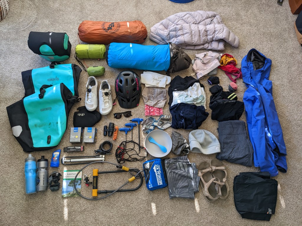
We packed only about three outfits for the trip to keep our weight down. This means we had to wash our clothes in campground and hotel sinks along the way and let them hang overnight to dry.
- The maps I listed earlier
- Gravel Bike: Trek Checkpoint
- Clothing (as much as I could I packed clothing that would function on the bike as well as for casual use around town)
- Padded shorts (2)
- Long-sleeve tops (2-3) the weather was in the high 50s, low 60s, so I did not bring short sleeve tops
- Leggings to wear over shorts for cold days and also around town (2)
- Socks (3 pair)
- Underwear (3)
- Sports bras (2)
- Rain Jacket (Arc’teryx Beta SL Hybrid)
- Neck protection (Buff Multifunctional Headwear)
- Waterproof pants
- Insulating down jacket
- Toiletries
- Medications/first aid kit
- Sunscreen
- All-purpose biodegradable soap
- Gear
- Waterproof bag for storing my sleeping bag
- Sleeping Bag (15 deg REI sleeping bag)
- Sleeping pad (REI Flash)
- Pillow (Cocoon Inflatable Air Core Pillow)
- Tent (Big Agnes Copper Spur HV UL3)
- Clipless cycling shoes
- Cycling gloves
- Helmet
- Sunglasses
- Shoe covers for cold days
- Lightweight walking shoes
- Headlamp
- Spare tube
- Water bottles (2)
- Bike lock (U-lock and cable)
- Panniers (Ortlieb Back-Roller Free)
- Cargo rack and cargo net
- Handlebar bag (Ortlieb Ultimate6 Pro M)
- Bell (important for letting others know you want to pass)
- Rear and front lights
- Camera
- Phone
- Portable USB charger
- Tire levers
- Portable tire pump
- Allen wrenches
- Velcro straps
*As an Amazon Associate I may earn a small amount from qualifying purchases at no extra cost to you.*

Leave a comment